We'll never forget when we sailed south off this coast back in September 2013 -- 48 hours of gales and "hazardous" steep seas combined with steering problems. Not fun.
MV Tiberborg appears to be experiencing even worse conditions, slowing its speed to less than 9 knots. But it is a large ship -- 172 m (L) x 20 m (B) -- so hopefully Pelagia and the other boats on deck are not having too rough of a trip.
Arrival in Chemainus delayed until late Sunday or Monday.
|
Showing posts with label offshore passages. Show all posts
Showing posts with label offshore passages. Show all posts
Friday, 12 June 2015
Gales and large seas off of Northern California slowing MV Tiberborg


Friday, 28 November 2014
Hasta la vista Mazatlan; Hola Baja
Finally "escaped" Mazatlan! Left 1030am Thursday and arrived 6pm Friday here in Bahia Los Frailes in Baja Californa Sur. (We were last here in December 2013.)
Arrived just as it became very dark -- lots of other boats anchored -- glad we've been here before and the weather forecast was benign.
A rocking, bouncy (and sometimes uncomfortable) sail across -- but we sailed sailed ALL the way (well, 150 of 160 nm). Close-hauled upwind, Finn our Hydrovane did a fantastic job.
Sunday, 27 April 2014
Almost there (Mazatlan)
After a couple of relaxing days at Ensenada Los Muertos, we left at about 4pm for a 2-night passage to Mazatlan. We HOPED for some winds....
We are currently (Sunday April 27) 15 nm from Mazatlan's marina district. The passage has been easy but relatively little sailing due to lack of wind. Oh well.
-----
At 4/27/2014 1:01 PM (utc) our position was 23°19.21'N 106°43.91'W
We are currently (Sunday April 27) 15 nm from Mazatlan's marina district. The passage has been easy but relatively little sailing due to lack of wind. Oh well.
-----
At 4/27/2014 1:01 PM (utc) our position was 23°19.21'N 106°43.91'W
Friday, 6 December 2013
Down the Pacific Coast of Baja: Ensenada to Cabo stats
We left Ensenada on November 18th, and arrived Cabo San Lucas on December 1st, a total of 14 days, including 6 lay days (3.5 days in Turtle Bay and 2.5 days in Bahia Santa Maria). We travelled (sailed/motored) a total of 151 hours, covering 746.7 nautical miles. In total (including battery charging, anchoring time, etc), we ran Pelagia's engine for 50.7 hours. We used only about 117 litres of diesel (only 43% of our tankage). Happily, we sailed at least 66% of the way. Not an easy trip, but not bad either.
Monday, 2 December 2013
Arrived Cabo San Lucas!
Crossed into the tropics yesterday and arrived Cabo San Lucas. More to come....
Friday, 22 November 2013
Passage south to Turtle Bay
We are now in Turtle Bay, approximately halfway down the Baja Peninsula. (Half way to Cabo!)
We left Ensenada about noon on Monday, and arrived Turtle Bay, in the dark, at about 9pm Wednesday. Our passage was almost entirely under sail, with 15-25 kn winds behind us. Seas were often quite boisterous (translation: we were tossed around quite a lot). During the night, we each took 3-hr-long shifts while the other tried to sleep. Day time was more fluid, but we often tried to grab some sleep then to make it easier during the night.
Nightime sailing is far far better than nighttime motoring. (And daytime sailing is far far better than daytime motoring....)
We were pretty tired -- think, jetlag -- on our first day in Turtle Bay. David did get ashore to help Dave from SV Confidence (they arrived the day before us) find a welder to fix a piece broken on his Monitor windvane. Turtle Bay village is very spread out and very dusty and windblown. Dave was successful in getting the part welded -- still waiting to hear if it worked.
Last night a weather system came in, and it has been pouring rain since the wee hours of the morning. More like a B.C. weather day. It is now 12 noon and it is still pouring. Not sure if we will get off the boat today or not.
Next sail is either to Bahia Santa Maria (2 nights and 2 days), with perhaps a stop in-between, depending upon winds. We may leave tomorrow (Saturday).
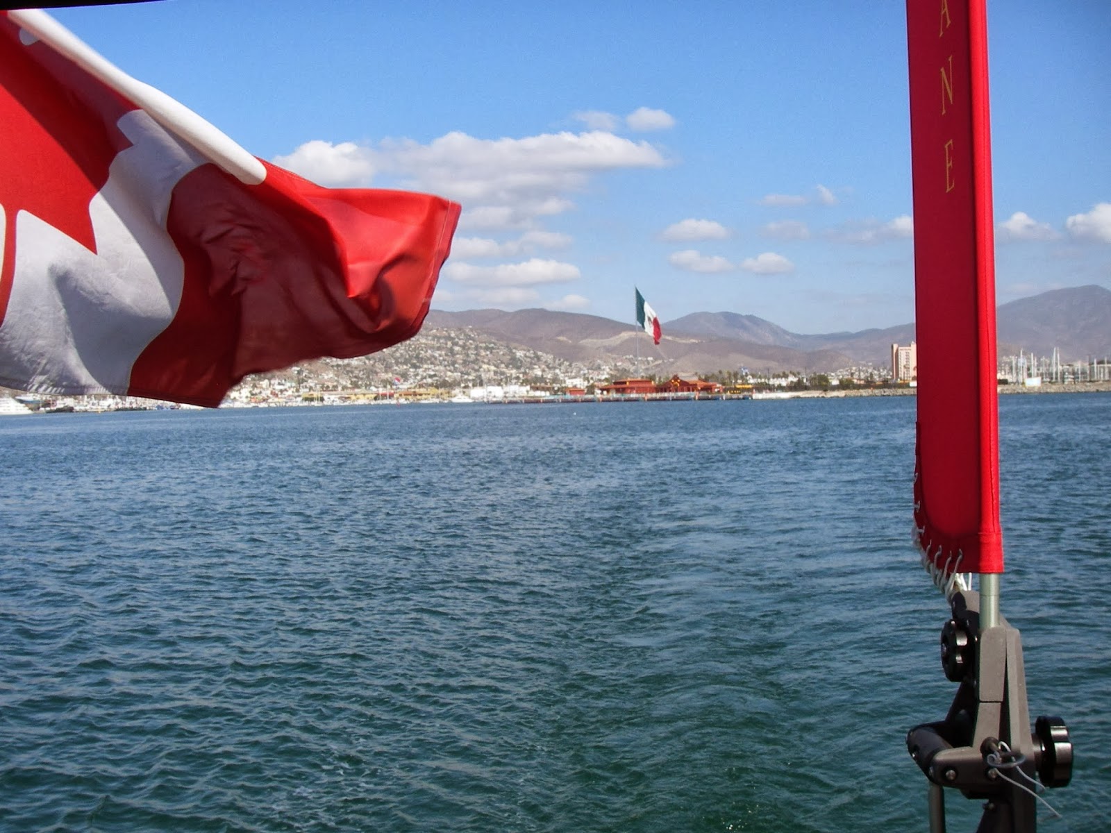 |
| Leaving Ensenada |
We left Ensenada about noon on Monday, and arrived Turtle Bay, in the dark, at about 9pm Wednesday. Our passage was almost entirely under sail, with 15-25 kn winds behind us. Seas were often quite boisterous (translation: we were tossed around quite a lot). During the night, we each took 3-hr-long shifts while the other tried to sleep. Day time was more fluid, but we often tried to grab some sleep then to make it easier during the night.
Nightime sailing is far far better than nighttime motoring. (And daytime sailing is far far better than daytime motoring....)
 |
| Approaching Cedros Island at dawn |
We were pretty tired -- think, jetlag -- on our first day in Turtle Bay. David did get ashore to help Dave from SV Confidence (they arrived the day before us) find a welder to fix a piece broken on his Monitor windvane. Turtle Bay village is very spread out and very dusty and windblown. Dave was successful in getting the part welded -- still waiting to hear if it worked.
Last night a weather system came in, and it has been pouring rain since the wee hours of the morning. More like a B.C. weather day. It is now 12 noon and it is still pouring. Not sure if we will get off the boat today or not.
Next sail is either to Bahia Santa Maria (2 nights and 2 days), with perhaps a stop in-between, depending upon winds. We may leave tomorrow (Saturday).
Sunday, 3 November 2013
VANCOUVER to SAN FRANCISCO & S. CALIFORNIA: Pelagia's route (August - October, 2013)

We would NOT recommend going out so far (70-100 nm) off of Oregon/Northern California. Weather was MUCH better closer to shore (<20 nm). As a compromise, perhaps stay between 30-50 nm offshore so that one can go in closer depending on the weather forecast.
Sunday, 22 September 2013
VANCOUVER to SAN FRANCISCO: The culprit (of our steering problems)
Here it is, the cause of our steering problems:
The seals on our Wagner cylinder were nearly gone -- especially on one side. Amazing the system steered reasonably well (under power). But totally understandable why the rudder couldn't hold under any weather helm when sailing. Seal on right side looks more like a wrapping of electrical tape rather than a double-lipped rubber seal.
Rodney at Svenson's Boatyard thinks the seal on right side of the shaft may have been damaged when it was installed. We'll never know.
New seals and all seems good now.
 |
| Bad seals on cylinder shaft |
Rodney at Svenson's Boatyard thinks the seal on right side of the shaft may have been damaged when it was installed. We'll never know.
New seals and all seems good now.
Saturday, 14 September 2013
VANCOUVER to SAN FRANCISCO: Some photos Neah Bay to SF
 |
| Rounding Cape Flattery (11am, Sept 2, 2013) |
 |
| Off-watch snooze |
 |
| On watch |
 |
| Reefing |
 |
| Our very experienced crew (Jim) |
 |
| Bad weather coming... |
During the gales, we were too "involved" to think of taking photos.... In retrospect, too bad.
 |
| Golden Gate Bridge (~1pm, Sept 9, 2013) |
 |
| Golden Gate "Lucky Hats" (a gift from Jim) |
VANCOUVER TO SAN FRANCISCO: Our route in detail
For those interested, here is a detailed graphic of our route from Neah Bay to San Francisco.
(If anyone is interested, we can send a gpx or kmz file.)
In retrospect, if we were to do this again, we would stay within 40-60 nm offshore (as we did on SV Sapphire in 2012):
 |
| Pelagia's route (September, 2013) |
(If anyone is interested, we can send a gpx or kmz file.)
In retrospect, if we were to do this again, we would stay within 40-60 nm offshore (as we did on SV Sapphire in 2012):
- winds within 60nm of shore were significantly less than we experienced (while we experienced 35 knot winds, closer to shore winds were 20-25 knots)
- <60nm is far enough out to be away from fishing fleets and traffic, but close enough to head in to harbour should a major blow (such as we experienced) be predicted
Monday, 9 September 2013
VANCOUVER to SAN FRANCISCO: (recap) Neah Bay to San Francisco Days 5 to 7: Gales, steep seas & steering problems
We had 48 hours of gales and steep seas off of the southern Oregon/northern California coasts. It was not fun, and made much worse by concern over problems with our hydraulic steering.
The forecast called for 20-30kn NW winds, with a warning of "steep hazardous seas".
COASTAL WATERS FORECAST
NATIONAL WEATHER SERVICE MEDFORD, OR
259 AM PDT FRI SEP 6 2013
COASTAL WATERS FROM FLORENCE OREGON TO POINT ST. GEORGE CALIFORNIA
AND WESTWARD 60 NM.
PZZ376-061600-
WATERS FROM CAPE BLANCO OR TO PT. ST. GEORGE CA FROM 10 TO 60 NM-
259 AM PDT FRI SEP 6 2013
..SMALL CRAFT ADVISORY FOR WINDS IN EFFECT FROM 2 PM PDT THIS
AFTERNOON THROUGH SATURDAY AFTERNOON...
..SMALL CRAFT ADVISORY FOR HAZARDOUS SEAS IN EFFECT FROM 2 PM
PDT THIS AFTERNOON THROUGH SATURDAY EVENING...
..GALE WATCH IN EFFECT FROM SATURDAY AFTERNOON THROUGH TUESDAY
EVENING...
..HAZARDOUS SEAS WATCH IN EFFECT FROM SATURDAY EVENING THROUGH
TUESDAY EVENING...
By 3pm, the winds had built to 20 knots; at 430pm, seas were building and winds were 24-27 knots. By 9pm. we had winds up to 38 knots with steep confused seas (12 feet with 7 second period!), sailing under mostly furled yankee only. Fin our Hydrovane was having significant trouble holding course, and we found our hydraulic steering was significantly slipping with any weather helm sailing. We decided to run under bare poles with the autopilot holding course while we made 5 knots. There were definite times we (or, at least, some of us) feared for ours and Pelagia's safety!
Next day was supposed to decrease to 20-25 knots. However, that night, we again had gale-force winds up to 36 knots and large seas. A lousy night. We kept the motor on due to our concern for the hydraulic steering. We also had Fin steer while motoring for about 12 hours -- but we stopped that after the Hydrovane rudder tube was found to have turned a bit off centre (turns out, the bolts all needed tightening: note for future routine maintenance).
By Day 7, winds and seas were down considerably. Such a relief! Nevertheless, concerned over the hydraulic steering, we motored on to Pt. Reyes, arriving at Drakes Bay in thick fog at 11:45pm.
Regardless of the late night, anchored in Drakes Bay, we quickly caught up on or "state-line" rums, plus a "few" more.
After arrival in San Francisco Bay, we headed to Alameda to arrange repairs. We were exhausted and needed days to catch up. (But at least our underwear were clean.... ;-)
The first 3-4 days of the trip were a good, albeit rough, sail. The last 3 had bad weather (gales and hazardous seas), significant equipment issues, fog and way too much motoring. The three of us -- David, Michelle and crew Jim -- did well together. We were very fortunate to have Jim join us as (very experienced) crew: Thank you Jim!
The forecast called for 20-30kn NW winds, with a warning of "steep hazardous seas".
COASTAL WATERS FORECAST
NATIONAL WEATHER SERVICE MEDFORD, OR
259 AM PDT FRI SEP 6 2013
COASTAL WATERS FROM FLORENCE OREGON TO POINT ST. GEORGE CALIFORNIA
AND WESTWARD 60 NM.
PZZ376-061600-
WATERS FROM CAPE BLANCO OR TO PT. ST. GEORGE CA FROM 10 TO 60 NM-
259 AM PDT FRI SEP 6 2013
..SMALL CRAFT ADVISORY FOR WINDS IN EFFECT FROM 2 PM PDT THIS
AFTERNOON THROUGH SATURDAY AFTERNOON...
..SMALL CRAFT ADVISORY FOR HAZARDOUS SEAS IN EFFECT FROM 2 PM
PDT THIS AFTERNOON THROUGH SATURDAY EVENING...
..GALE WATCH IN EFFECT FROM SATURDAY AFTERNOON THROUGH TUESDAY
EVENING...
..HAZARDOUS SEAS WATCH IN EFFECT FROM SATURDAY EVENING THROUGH
TUESDAY EVENING...
|
| WeatherFax for Sept 10, 2013: Surface and Wind/Wave(m) forecasts |
By 3pm, the winds had built to 20 knots; at 430pm, seas were building and winds were 24-27 knots. By 9pm. we had winds up to 38 knots with steep confused seas (12 feet with 7 second period!), sailing under mostly furled yankee only. Fin our Hydrovane was having significant trouble holding course, and we found our hydraulic steering was significantly slipping with any weather helm sailing. We decided to run under bare poles with the autopilot holding course while we made 5 knots. There were definite times we (or, at least, some of us) feared for ours and Pelagia's safety!
Next day was supposed to decrease to 20-25 knots. However, that night, we again had gale-force winds up to 36 knots and large seas. A lousy night. We kept the motor on due to our concern for the hydraulic steering. We also had Fin steer while motoring for about 12 hours -- but we stopped that after the Hydrovane rudder tube was found to have turned a bit off centre (turns out, the bolts all needed tightening: note for future routine maintenance).
By Day 7, winds and seas were down considerably. Such a relief! Nevertheless, concerned over the hydraulic steering, we motored on to Pt. Reyes, arriving at Drakes Bay in thick fog at 11:45pm.
Regardless of the late night, anchored in Drakes Bay, we quickly caught up on or "state-line" rums, plus a "few" more.
After arrival in San Francisco Bay, we headed to Alameda to arrange repairs. We were exhausted and needed days to catch up. (But at least our underwear were clean.... ;-)
The first 3-4 days of the trip were a good, albeit rough, sail. The last 3 had bad weather (gales and hazardous seas), significant equipment issues, fog and way too much motoring. The three of us -- David, Michelle and crew Jim -- did well together. We were very fortunate to have Jim join us as (very experienced) crew: Thank you Jim!
VANCOUVER to SAN FRANCISCO: Arrived San Francisco!
Arrived Drake's Bay in thick fog Sunday eve at 11pm. Anchored. Had several excellent stiff rums, and had the first quiet motionless sleep in a week.
On Monday, after several hours of motoring in windless thick fog, we arrived under the Golden Gate Bridge about 2pm on Monday September 9th -- could barely see the bridge.
Inside the Bay, it was mostly clear and blowing 26 knots.
We are now at the friendly Oakland Yacht Club over in Alameda.
More to come!
Friday, 6 September 2013
VANCOUVER to SAN FRANCISCO: Days 4 & 5 (am): Neah Bay to San Francisco
Spoke (wrote) too soon in last post. We've had over a day of light-to-no winds combined with uncomfortable swell. So lots of motoring, interspersed with trying to sail. Over the 4.5 days, we've sailed at least 80% of the time (actually, we've motored only 13 hours since Cape Flattery on Monday). Last night's sails up/sails down etc left us pretty tired today.
This morning we jibed back towards the coast -- we were getting to be too far out. Likely we'll try to stick around 50-70 nm out. Currently sunny with 10-15 kn NW from behind. Good sailing though rolly. Fin our Hydrovane has been doing a standup job the whole trip.
Biq question now is the weather. We download text forecasts and weather faxes -- there is such a confusing plethora of regions etc. But it seems we are in for some 25-35 kn NW weather with large seas Sat/Sunday. Oh great, another test.
We may not have shown up on AIS due to our distance from the shore. We may show-up now as we close within 60 nm again. We've been posting position reports on YOTREPS.
This is a slower trip than last year -- there will be no "5 or 6 days" to SF this time. Currently we are about 70 nm due west of Crescent City. We cross a state line tonight. Yippee, another S-L drink! (The last one 2 nights ago was wonderful.)
All for now.
-----
At 9/6/2013 5:26 PM (utc) our position was 42°28.35'N 126°10.22'W
----------
radio email processed by SailMail
for information see: http://www.sailmail.com
This morning we jibed back towards the coast -- we were getting to be too far out. Likely we'll try to stick around 50-70 nm out. Currently sunny with 10-15 kn NW from behind. Good sailing though rolly. Fin our Hydrovane has been doing a standup job the whole trip.
Biq question now is the weather. We download text forecasts and weather faxes -- there is such a confusing plethora of regions etc. But it seems we are in for some 25-35 kn NW weather with large seas Sat/Sunday. Oh great, another test.
We may not have shown up on AIS due to our distance from the shore. We may show-up now as we close within 60 nm again. We've been posting position reports on YOTREPS.
This is a slower trip than last year -- there will be no "5 or 6 days" to SF this time. Currently we are about 70 nm due west of Crescent City. We cross a state line tonight. Yippee, another S-L drink! (The last one 2 nights ago was wonderful.)
All for now.
-----
At 9/6/2013 5:26 PM (utc) our position was 42°28.35'N 126°10.22'W
----------
radio email processed by SailMail
for information see: http://www.sailmail.com
VANCOUVER to SAN FRANCISCO: Days 3 & 4 Neah Bay to San Francisco
Wednesday saw us sailing very comfortably in 10-15 knot SE winds, with much reduced swell. Not a fast sail, but enjoyable. Wednesday eve the forecast decrease in winds came late at night (after a brief squall causing a reef in the main late in the night). Thursday morning (5am), the winds left us. So we motored.
By 9am we were back sailing, the wind clocking around to the NE. Expected to increase to NW 15-20 tonight and 20-30 over the weekend. Oh boy.
Crew is all well (a little tired from last night's antics).
Current location (Thursday @ 10am PDT): 44 degrees 05.4 minutes N; 126 degrees 30.86 minutes W
-----
By 9am we were back sailing, the wind clocking around to the NE. Expected to increase to NW 15-20 tonight and 20-30 over the weekend. Oh boy.
Crew is all well (a little tired from last night's antics).
Current location (Thursday @ 10am PDT): 44 degrees 05.4 minutes N; 126 degrees 30.86 minutes W
-----
Tuesday, 3 September 2013
VANCOUVER to SAN FRANCISCO: Days 1 & 2 Neah Bay to San Francisco: Mr. Toad's Wild Ride!
One night at the dock and 1 night at anchor in Neah Bay. Forecast off the Washington coast was for SE 10-15 knots with 5-6 foot SW swell. NW winds were not forecast until at least Wednesday. Other boats (4 of 6) decided to wait it out until Wed.(Current forecasts now indicate the NW winds will not begin until later Thursday (and will be light).
So, we decided to head out.
It has been a wild bouncy noisy ride. We are currently 60 nm West of Gray's Harbour. Heading approximately South (200 deg T) at ~4.5 kn. One reef in the mainsail and genoa furled down 20%. Likely another 18-24 hrs of this. THEN comes possibly too light NW winds.
We shall see. See our positions and AIS track are found on the "Where are we" page.
-----
At 12/30/1899 12:00 AM (utc) our position was
So, we decided to head out.
It has been a wild bouncy noisy ride. We are currently 60 nm West of Gray's Harbour. Heading approximately South (200 deg T) at ~4.5 kn. One reef in the mainsail and genoa furled down 20%. Likely another 18-24 hrs of this. THEN comes possibly too light NW winds.
We shall see. See our positions and AIS track are found on the "Where are we" page.
-----
At 12/30/1899 12:00 AM (utc) our position was
Sunday, 1 September 2013
VANCOUVER to SAN FRANCISCO: Neah Bay... waiting for wind
Long motor yesterday Port Angeles to Neah Bay. At least it was sunny and calm.
Currently in Neah Bay waiting for some winds. Likely we will leave tomorrow with a forecast of S/SE 10-15 kn winds (yes, winds against us, but at least not too much).
Pacific High not expected until at least Wednesday.
Happy Labour Day.
Currently in Neah Bay waiting for some winds. Likely we will leave tomorrow with a forecast of S/SE 10-15 kn winds (yes, winds against us, but at least not too much).
Pacific High not expected until at least Wednesday.
Happy Labour Day.
Thursday, 29 August 2013
VANCOUVER to SAN FRANCISCO: A very foggy trip to Port Angeles
A very foggy motor across the traffic lanes to Port Angeles. Anxiety causing. Especially difficult coming into the harbour in near-zero visibility. Very friendly US customs. Weather forecast for sailing down the coast NOT friendly (either winds against or no wind).
But the booze is cheap and we are fine....
But the booze is cheap and we are fine....
Wednesday, 28 August 2013
VANCOUVER to SAN FRANCISCO: Day 2: Anchored in Cadboro Bay
A calm motor from Montague Harbour to Cadboro Bay. Some fog. Last night we got hit by unexpected/unforecast NW winds (to 18 kn) while we were anchored at the NW anchorage off the beach of Montague. We had to move to another anchorage in 0 visibility, pouring rain. A good team-building exercise... :-)
-----
At 8/29/2013 3:29 AM (utc) our position was 48°27.30'N 123°17.63'W
----------
radio email processed by SailMail
for information see: http://www.sailmail.com
-----
At 8/29/2013 3:29 AM (utc) our position was 48°27.30'N 123°17.63'W
----------
radio email processed by SailMail
for information see: http://www.sailmail.com
Tuesday, 27 August 2013
VANCOUVER to SAN FRANCISCO: DEPARTURE DAY!
Today we leave for San Francisco...finally!
Nope, not all is done, but it is time to go.
We will stop at least 2 nights around the Gulf Islands/Victoria area before crossing over to Port Angeles in the USA. However, current weather forecasts for the coast of Washington state are not favourable for us (S or SE winds ... i.e., winds against us), so we may be waiting for a better weather window.
Below (and on our "Where are we?" page) is how to follow us on the web:
POSITION REPORTS: CHECK THE WEB TO SEE WHERE WE ARE/HAVE BEEN
We are now sending in "position reports" to Winlink and/or YOTREPS (when we are out cruising). These reports are visible on a map on the web
Preferred:
View Pelagia's Position Reports (SHIPTRACK)
Alternative:
View Pelagia's Position Reports on YOTREPS
View Pelagia's Position Reports (Winlink 2000)
VIEW OUR "LIVE" POSITION ON AIS
http://www.marinetraffic.com/ais/datasheet.aspx?datasource=ITINERARIES&MMSI=316014173
Or, use our MMSI number 316014173 on any other web-based AIS system to follow us.
Note: Don't worry if we do not show up on AIS. AIS only works while we are on the move. Importantly, there must be shore stations nearby to receive our signal (there are no stations on the northern coast of Washington (Olympic Peninsula)). Also, if we are farther than 50-75 miles off the coast, we will not show up.
Nope, not all is done, but it is time to go.
We will stop at least 2 nights around the Gulf Islands/Victoria area before crossing over to Port Angeles in the USA. However, current weather forecasts for the coast of Washington state are not favourable for us (S or SE winds ... i.e., winds against us), so we may be waiting for a better weather window.
Below (and on our "Where are we?" page) is how to follow us on the web:
POSITION REPORTS: CHECK THE WEB TO SEE WHERE WE ARE/HAVE BEEN
We are now sending in "position reports" to Winlink and/or YOTREPS (when we are out cruising). These reports are visible on a map on the web
Preferred:
View Pelagia's Position Reports (SHIPTRACK)
Alternative:
View Pelagia's Position Reports on YOTREPS
View Pelagia's Position Reports (Winlink 2000)
VIEW OUR "LIVE" POSITION ON AIS
http://www.marinetraffic.com/ais/datasheet.aspx?datasource=ITINERARIES&MMSI=316014173
Or, use our MMSI number 316014173 on any other web-based AIS system to follow us.
Note: Don't worry if we do not show up on AIS. AIS only works while we are on the move. Importantly, there must be shore stations nearby to receive our signal (there are no stations on the northern coast of Washington (Olympic Peninsula)). Also, if we are farther than 50-75 miles off the coast, we will not show up.
Sunday, 25 August 2013
VANCOUVER to SAN FRANCISCO: Time ticking down... departure in 3 days (hopefully)
Time is ticking. We are currently planning to leave for San Francisco sometime Tuesday August 27th. (Of course, this is subject to last-minute hiccups.)
We have the great fortune of having our friend Jim from SV Berkana join us as crew to San Francisco. We sailed with Jim on Berkana Hawaii to Vancouver in 2004. One couldn't get a more experienced crewmember!
It has been a very busy 3 weeks -- very tiring -- getting ourselves and Pelagia ready. Won't get it all done. A very typical situation, apparently.
More to come.
|
Subscribe to:
Posts (Atom)