Showing posts with label Mexico. Show all posts

Saturday, 26 March 2022

The best chart package combination for Pacific Mexico: OpenCPN and O-CHARTS

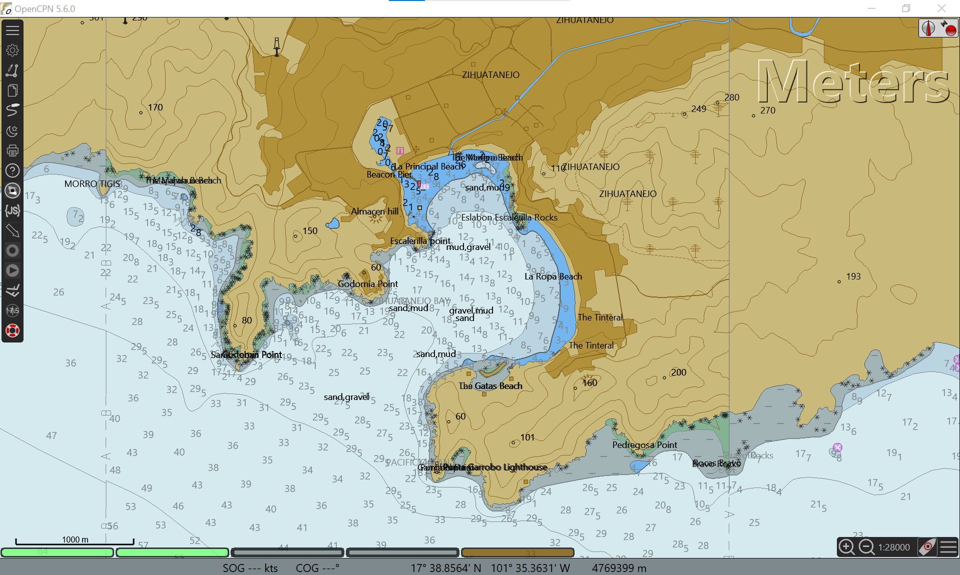
Zihuatanejo harbour (O-Charts & OpenCPN)


Best charting package: OpenCPN

(when combined with charts available for OpenCPN)

I have long touted OpenCPN. It is the most (or among the most) full-featured charting packages. It is continuously being updated/upgraded with new features, and support easily obtained.

My favourite OpenCPN features:

  • Accepts most chart types: Raster [BSB/KAP (such as CHS and NOAA raster files), mbtiles; Vector (S57 ENC (such as free NOAA files), some S63, CM93v2, and  O-SENC]
  • Excellent waypoint creation and management
  • Excellent route creation and management
  • Presentation of AIS target information 
  • VDR (Voyage Data recorder): Save depth, AIS, etc data for later re-playing (and creation of depth surveys) 
  • and much more!

This open-source charting package is available free for PC, MAC and Linux, and for a very small one-time fee for Android. (Due to Apple's iOS licensing issues, OpenCPN is not available for iPhone or iPad.)


Best source of charts for Mexico's Pacific Coast: O-Charts

I've recently had the opportunity to review the O-Charts (Open Charts) Mexico charts. I've focused on the Pacific coast.


(1) O-Charts' SEMAR charts:

A new addition, O-Charts now offers official Mexico charts from Mexico's SEMAR. Charts are in two sets, one for Mexico's Pacific coast and the other for Mexico's Gulf of Mexico coast. Each chart set is offered for a very reasonable price (26 to 30 euros/set), which includes free updates for 1 year (update frequency is reported to be weekly). Most of these charts are fairly recently issued and/or have received recent updates. They are not old charts "from the 1800s" so often alluded to by misinformed cruisers.

SEMAR (O-Charts): Entrance to Sabalo (Mazatlan)

SEMAR (O-Charts): Sabalo (Marina Mazatlan)

Pacific Mexico: The O-Charts' SEMAR packages are from SEMAR's ENC (vector) charts. NOTE: Although extensive, the SEMAR ENC collection is missing several charts from their RASTER collection. This means a few key locations for cruisers are missing from O-Charts' SEMAR package. With two exceptions (see below), these few locations on raster charts missing from SEMAR ENC are all easily replaced by also purchasing Blue Latitude raster charts from O-Charts.

Commercial chart sources, such as Navionics and C-MAP, all obtain their Mexico chart information from SEMAR. Sometimes these commercial charts include data from both vector and raster from SEMAR are included, other times only vector. 

However, it is important to note that SEMAR data (and thus Navionics/C-MAP) usually does not cover popular small-boat anchorages. 

The solution is to add Blue Latitude charts, as shown in the following example for Isla San Francisco, below:


Navionics: no data for Isla San Francisco

SEMAR (O-Charts): no data for Isla San Francisco

Blue Latitude (O-Charts): Detailed Isla San Francisco
Blue Latitude (O-Charts): Detailed chart for Isla San Francisco (from guidebook)


(2) O-Charts' Blue Latitude charts: 

O-Charts has for some time offered the two Blue Latitude chart sets for the Sea of Cortez and Pacific Mexico (36 euros per set). These chartlets, found also in the excellent Blue Latitude guidebooks, provide GPS-accurate charts for all the main harbours and hundreds of small-boat anchorages on Mexico's Pacific coast (excluding the west coast of the Baja peninsula). NO other charts provide such detail.  

These charts are essential for west coast cruisers.  


For cruisers, the combination of SEMAR and Blue Latitude charts, both available from O-Charts, provide excellent coverage of Mexico's Pacific coast.


The two important exceptions:

O-Charts SEMAR Pacific chart set is missing detailed charts for two key locations for cruisers on the west coast of Baja: Turtle Bay and Bahia Santa Maria/Bahia Magdalena. Unfortunately, these locations are not part of the Blue Latitude chart sets, as they do not cover Baja's west coast. 


There are easy solutions for charts for these two Baja locations:

  • Most up-to-date chart cards for chartplotters (Navionics, C-MAP) will have detailed charts for these two Baja locations (derived from SEMAR's detailed raster charts)*
  • Navionics and C-MAP iOS/Android apps also contain detailed charts*


* Note: Navionics/C-MAP do not provide more detailed charts (compared to O-Charts' SEMAR) for other areas of the west coast of Baja. For the many poorly charted locations on Baja's west coast, I recommend making detailed satellite images (mbtiles are best) using SASPLANET/SAT2CHART and OpenCPN.

Thursday, 19 May 2016

Mexico charts: C-MAP versus NAVONICS

This post provides further information for cruisers considering/planning a cruise to Pacific Mexico. Preceding posts include: (i) Charts, Cruising Guides & Weather Sources for Mexico, (ii) C-MAP vs SEMAR charts, (iii) CM-93 vector charts, and (iv) using Google Earth and GE2KAP to create GPS-accurate GE image "charts". 
 

UPDATE March 2022: See new post on "Best chartplotter and chart source for Mexico: OpenCPN & O-CHARTS"

UPDATE 2021(Jan): For the locations noted below, both C-MAP and Navionics now show the same updated details. However, the newer more-detailed SEMAR raster chart (but not included in the SEMAR vector set) for "the islands" in Bahia de la Paz (THE main cruising area for boats out of La Paz, BCS) is missing from CMAP and incorrect for Navionics (I prefer "no data" to "wrong data"!)

The differences noted below in this 2016 post show the kind of differences that can exist (the ones below are now corrected). The only way to know if a commercial chart is updated is to compare to up-to-date SEMAR charts.


2016 post:
In a number of preceding posts, we've noted that in some places in Mexico, "up-to-date" Navionics charts lack the updated detail found in "up-to-date" C-MAP charts.

Increased detail in a chart does not guarantee the chart is more "accurate"; however, it likely indicates the chart has added in updates from the official Mexican nautical chart supplier, SEMAR. 

Below are several examples in the Sea of Cortez (and south to San Blas) where we've found Navionics charts lacking in detail compared to C-MAP charts. Readers may find the opposite in other areas (although we have not seen this).

In the examples below, the C-MAP image is always on top and the Navionics on the bottom. Each is zoomed so that the maximum detail available is shown.


La Palmita anchorage (south of B. Conception):


Loreto:


Altata:


San Blas/B. Matanchen:


Cruisers should use multiple sources of information rather than relying solely on only one commercial chart source (e.g., Navionics or C-MAP). Given the relatively low expense of Navionics and C-MAP electronic charts, especially on IOS and Android platforms, it makes sense to use both (as well as charts from CM93, GE-image, Blue Latitude Press, and, if you have them, SEMAR).

Importantly, as we have seen up in BC waters, commercial charts such as Navionics and C-Map are often not up-to-date with official chart sources (and may take months to over a year to include an update).

Both Navionics and Jeppesen/C-MAP provide methods to report a "Cartography Discrepancy". However, these require some work to submit, and for large areas where a chart does not include the most up-to-date cartography provided by the official cartography office (in this case, SEMAR), it would seem the responsibility of the electronic chart provider to keep their charts for sale to the public up-to-date!  

Sunday, 20 March 2016

What year are your CM93 electronic charts? Make sure they are the "latest"! (HOWEVER: ALL CM93v2 charts are OUT-OF-DATE!)

 ******************************************************************************
UPDATE/COMMENT: This post concerning "CM93" charts is proving to be very popular. It must be noted that CM93 Version 2 charts are usually far from being "up-to-date"; certainly NOT the best charts"available, so users of these charts must be cautious. Often, they are totally out-of-date, and dangerous. In some cases, C-MAP or Navionics electronic charts (which are fairly inexpensive on Android and IOS platforms) may be more accurate. However, as we have noted in other posts, Navionics or CMAP charts may also not be fully up-to-date.

NOTE that Mexico's SEMAR issues new charts every year (as well as updates). For example, in 2018, SEMAR issued a new, detailed, chart for the islands in Bahia de La Paz. (Unfortunately, this chart is available only as pricey paper chart or Raster, and not in their vector/ENC collections (such as excellent O-charts).

THIS POST offers the best solution for electronic charting in the west coast of Mexico: OpenCPN, O-Charts Pacific Mexico, and Blue Latitude garbour charts, plus a couple SAT2CHART/SASPLANET charts to fill a couple "holes".
******************************************************************************

CM93 vector electronic charts, covering the whole world, are shared widely among cruisers; they are also available from some sites on the web. Technically, these charts are "pirated", so user beware....

[Note: By "latest", we mean the most recent CM93 available which works in OPENCPN]

CM93 "version 2" charts are easily used in the open-source, freely available, OPENCPN navigation program (CM93 "version 3" charts do not work in OPENCPN).

When we were planning to sail to Mexico, a cruising friend gave us a copy of the CM93 charts. We were impressed that they covered the globe; we were less impressed when we saw their lack of detail. This was especially the case when we left the highly accurate (and free) raster charts of the USA and entered Mexico. In Mexico, we quickly learned (i) our CM93 charts were nearly useless, (ii) our updated CMAP charts (on our chartplotter) were much better, and (iii) in many (most?) places, even our up-to-date CMAP charts provided insufficient detail.* As we note in our earlier blog posts about charts and guides (as well as comparing official Mexican SEMAR charts with CMAP charts), we did not feel confident navigating close to shore until we reached Cabo San Lucas where we could finally use the excellent Blue Latitude Press cruising guides, with their excellent, detailed chartlets and accurate waypoints.

[*Our experience with Navionics charts in Mexico indicates they suffer similar problems as CMAP charts; indeed, we note areas where CMAP has important detailed updates not found in the Navionics. See our blog posts concerning CMAP, Navionics and SEMAR charts.]

It turns out, we were using a very out-dated version of  the CM93 vector charts, dated mostly before the year 2000. Since returning home, we have found CM93 version 2 charts dating as late as 2012. The differences (improvements) over the years are substantial.

To help other cruisers, the examples below show the improvements in the CM93 charts for the years "2000", "2007" and "2012" (dates are approximate).


Turtle Bay/Bahia Tortugas (Baja California Sur)
Our first real experience with CM93 charts coming in to an unfamiliar bay. 

Our circa-2000 CM93 chart was useless: no details, no depths, and the datum way off (on the other hand, the CMAP turned out to be pretty good).


The circa-2007 CM93 has much more detail and correct datum, although lights were not correct.


The circa-2012 CM93 chart for Turtle Bay is quite accurate (determined using GE2KAP and Google Earth (see this blog post) -- we wished we'd had it back in 2013!


La Paz, Baja California Sur
Both our circa-2000 CM93 charts and our CMAP chart showed few details and were inaccurate for the section from (and including) Bahia Los Frailes, to Ensenada de Los Muertos, the Cerralvo Channel, and finally, the San Lorenzo Channel entering Bahia de La Paz (they still are...). The Blue Latitude Press Sea of Cortez cruising guide was a godsend.


We entered the narrow, dogleg channel entering La Paz harbour just as the sun began to rise (we had left Los Frailes in the morning and done an overnight trip from Los Muertos in order to beat a Northerly, accurately predicted to come fiercely the next day). The circa-2000 CM93 chart showed NO details; fortunately, the CMAP chart showed good detail which turned out to be very accurate (though we did not know/trust this at the time).


Again, we wished we had the 2012 CM93 charts as confirmation of the CMAP (and Blue Latitude Press) information.


Punta Sabalo/Estero de Sabalo/Marina Mazatlan

In late April 2014, it was time to sail across the Sea of Cortez to Marina Mazatlan in the Estero de Sabalo, where we planned to keep Pelagia for the 2014 hurricane season. Again, our circa-2000 CM93 charts were useless. Our CMAP chart was also incomplete, although it had much more and better information than CM93 (the June 2014 CMAP update provided much more information for this area).


The circa-2012, CM93 chart shows an outline of the Marinas in the Sabalo Estero, but with few details. Fortunately, the combination of our CMAP charts and the Blue Latitude Press Pacific Mexico guide gave us the information we needed.


Other places in Mexico where CM93 2012 charts are inadequate (or useless) compared to official SEMAR charts: 

The list is too long. 

But, for example:

Puerto Los Cabos (San Jose del Cabo): nonexistent on CM93

Marina Coral (Ensenada): nonexistent on CM93

Marina Costa Baja (La Paz, BCS): nonexistent on CM93

"The Islands", Bahia de la Paz (new (2018) detailed chart): nonexistent on CM93

Topolobampo: details nonexistent on CM93

Bahia de Altata:  details nonexistent on CM93

Marina at La Cruz and Paradise Marina (Banderas Bay): nonexistent on CM93

The list goes on and on.... 


CM93 charts in Canada?

After seeing these large changes (improvements) in the various versions of the CM93 charts, we wondered how the CM93 charts would look in our home waters in British Columbia.#

The circa-2000 CM93 charts are terrible for BC waters, even on the south coast of BC (even though most areas in 2000 were exquisitely charted by the Canadia Hydrographic Service (CHS) as well as preceding (mostly British) cartographers). However, by 2012, the CM93 charts are quite good.

Further north in British Columbia, there remain "pockets" of unsurveyed (or poorly surveyed) coastline -- almost all well away from typical routes. One area is "Lady Trutch Passage" on the Central Coast near Bella Bella. This passage always looked inviting, but was choked with narrow passages and no chart was available. However, in 2011, the CHS produced a new very detailed chart including Lady Trutch Passage. Interestingly, the circa-2012 CM93 chart includes this detailed information; the circa-2007 CM93 chart as a subset of this new charting; and predictably, the circa-2000 CM93 "chart" is hopeless for this area, even for the relatively well-traveled (and well-charted for years) "Perceval Narrows".

Circa-2000 CM93 "chart" for Lady Trutch Passage area: USELESS


CM93 "2007" chart for Lady Trutch Passage area: VERY incomplete


Pretty good, detailed CM93 "2012" chart for Lady Trutch Passage area


Obviously, anything "new" since 2012 (marinas, rocks, shallows, buoys... etc) will not be correct on the "latest" CM93 v2 charts (approx 2012).

(# Legally, in Canada, vessels must carry up-to-date CHS charts, so technically, circa-2012 CM93 charts are not sufficient; of course, neither are CMAP or Navionics charts.)


Before we sailed down to Mexico, we wish we had been aware of the substantial changes in the CM93 electronic charts. We should have been... but we were probably too wrapped-up in too many things as we prepared to sail to Mexico, and as were were on our way down the coast.

Hopefully, some cruisers heading offshore will find this blog post helpful!

Friday, 18 March 2016

UPDATE: Change (temporary) in Geary's SONRISA NET Mexico weather forecasts from the web and via saildocs

APRIL 10, 2016 UPDATE: It appears that Sonrisa Net weather website is now up and running correctly and obtaining Geary's forecasts via Saildocs now working fine.

Ignore updates etc below....

HOWEVER check out Pelagia's info re Mexico cruising weather (& charts, cruising guides, etc), go to this post:


APRIL 7th UPDATE:
It appears that the Sonrisa Net weather website is now being updated,  except for the "Daily Summary" (still shows February 18th summary) which is updated on Geary's "Blog" on Weather Underground.

Unfortunately,  it does not appear that requests ("queries") to SAILDOCS for Geary's forecasts are working properly (see below for workaround to get forecast via Saildocs) .


Important Update March, 2016:
Geary's SONRISA NET weather website and associated Saildocs files for the Pacific coast of Mexico (especially Baja and the Sea of Cortez) have not been updating over the past month.

HOWEVER: He still does his daily forecast over HAM radio on the Sonrisa Net AND publishes an up-to-date forecast on his blog on the Weather Underground website:

http://www.wunderground.com/blog/Geary/show.html

To get a copy of Geary's latest forecast from SAILDOCS, send the following to SAILDOCS (replace the date: the example is for March 18, 2016):

send http://www.wunderground.com/blog/Geary/gearys-sea-of-cortez-weather-for-031816

NOTE: Saildocs will send a copy of the html file as a text file. This message will be unreadable until is saved as a .html file, and then read by your web browser.


The July 2014 post regarding Mexico weather info has been updated:
http://sailing-pelagia.blogspot.ca/2014/07/information-for-cruising-mexico-charts.html

Thursday, 3 December 2015

2015: A very busy season for hurricanes in the Eastern Pacific and Mexico


According to NOAA, the 2015 Eastern Pacific Hurricane Season was a record-setting season:

The eastern Pacific saw 18 named storms, including 13 hurricanes, nine of which became major.  This is the first year since reliable record keeping began in 1971 that the eastern Pacific saw nine major hurricanes. Hurricane Patricia was the strongest hurricane on record in the Western Hemisphere in terms of maximum wind speed at 200 miles per hour and lowest air pressure at 879 millibars. Hurricane Sandra, which formed at the tail end of the season, was the strongest hurricane in the eastern Pacific so late in the year, with a maximum sustained wind speed of 145 miles per hour.

The central Pacific shattered its records too, with 14 named storms, including eight hurricanes, five of which became major hurricanes, the most active season since reliable record-keeping began in 1971. Three major hurricanes (Ignacio, Kilo and Jimena) churned at the same time east of the International Dateline, the first time that was ever recorded.

2015 Tropical Storms/Hurricanes

Source: NOAA


Hurricanes approaching Baja California as early as early June (H. Blanca) and as late as late November (H. Sandra).

Something to think about when planning sailing to/from Baja California!

Friday, 23 October 2015

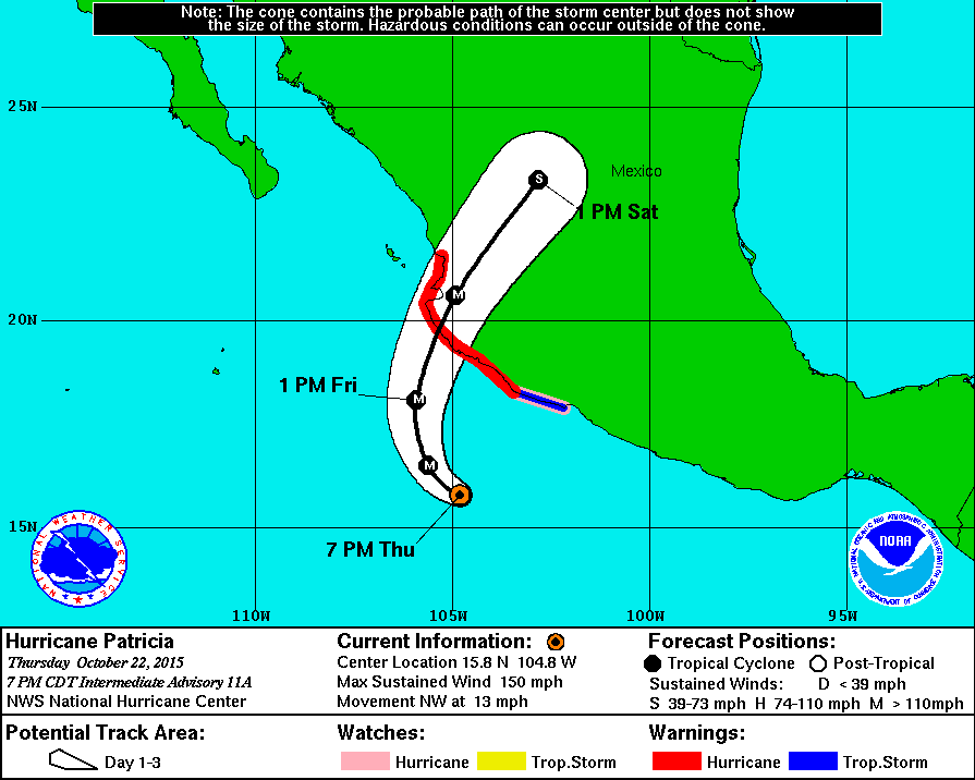
Super Hurricane Patricia comes ashore near Manzanillo

A huge hurricane,  Patricia packed winds of at least 150 knots.  Coming ashore near Manzanillo,  Patricia is the strongest  hurricane ever to hit the Americas (and possibly anywhere).


Our thoughts go out to friends with boats in the area, and especially to the Mexicans living and working in the area.


AFTER THE HURRICANE UPDATE:
Cruising boats in Barra de Navidad fared pretty well; locals not so well. Friends Betty Anne and David on SV Confidence have a full description of the experience of Hurricane Patricia on their blog: http://cruiseoftheconfidence.blogspot.gr/2015/10/hurricane-patricia-2015-part-three.html

Monday, 5 October 2015

Heading down the Pacific coast of Baja California? Create GPS-accurate electronic "charts" using SAT2CHART and SASPLANET satellite images

UPDATE: See this post:

The best chart package combination for Pacific Mexico: OpenCPN and O-CHARTS  

Recommends combination of OpenCPN/O-Charts MexicoENC/Blue Latitude chartlets. Includes a link to charts for Turtle Bay and Bahia Santa Maria, missing from the SEMAR ENC-chart collection (for west coast Baja).  

UPDATE: Better image chart etc (from ArcGIS) for Abreojos BCS, plus link to download for Abreojos waypoint (gpx) and image (kap) files. Scroll to bottom. 

UPDATE:  I find it easier to make these charts using the combination of SASPlanet, ArcGIS ESRI, and SAT2CHART. MBTILES is the better format.

UPDATE: The "chartlocker" has free, pre-made, mbtiles of satellite charts for Baja (and elsewhere): https://chartlocker.brucebalan.com/ 

UPDATE: Google Earth images are reasonably good, but other sources provide even better (higher resolution/clearer images). I find Bing much better than Google Earth; sometimes better are the images from ArcGIS ESRI. Use free SASPlanet software to make charts from ESRI. "How to" explained here.


On previous posts, we discussed various charts, official Mexico nautical charts, cruising guides, weather sources, and  communications. In the current post, we discuss using GPS-accurate electronic "charts" derived from Google-Earth images to supplement navigation resources when cruising the Pacific coast of Baja California.

March 2016: see also post concerning CM93 electronic charts.

THE PROBLEM: When we left Ensenada in November 2013 to sail down the Pacific coast of Baja California, we had our first encounters with navigating a coast where charts were often out-of-date, inaccurate, and lacking detail.

We had two guidebooks, both new (2013) editions (Charlie's Charts; and  Rain's Mexico Boating Guide). We also had paper charts in a Yachtsman's Chartbook, and CM93 electronic charts -- both of which we could see, before leaving, were lacking sufficient detail and accuracy. Importantly, in addition to these, we had an up-to-date C-MAP chart card for our Furuno chartplotter (also usable in our computer). In some places, the C-MAP card showed much better detail than the CM93 or Yachtsman's charts; in many other places the C-MAP chart were also lacking sufficient detail. In contrast with the excellent accuracy of the C-MAP charts in the USA and Canada, we had no idea as to the GPS accuracy of these charts in Baja California.

Two nights and two days after leaving Ensenada, wanting some sleep, we considered anchoring on the east side of Cedros Island at an anchorage called "La Palmita", indicated by both guide books. However, without any information on a chart or guidebook chartlet, zero detail on the C-MAP chart, and a depth sounding far off of what we were recording, we chickened out and continued on to Bahia Tortuga (Turtle Bay) -- losing about 1 hour of valuable daylight.

No detail and inaccurate chart for Isla Cedros' La Palmita anchorage: well within the "10 foot" depth contour, we still had >150' showing; it didn't help that the anchorage waypoint was showing on land. So we gave up and headed for Turtle Bay. (Interestingly, only a couple nautical miles south, the chart became very detailed (i.e., C-MAP included the new Mexican/SEMAR chart for Cedros town, produced in 2012.)

With daylight fading, we just made it through the "Canal de Dewey" (narrow channel between Punta Eugenia & Isla Natividad) before dark -- with so many lobster traps, so much kelp, and reefs, combined with currents, we would never do Dewey in the dark.


In contrast to most anchorages down Baja's Pacific coast, the C-MAP chart for Turtle Bay had quite a bit of detail. However, as we sailed towards Turtle Bay in the dark, we did not yet know whether or not there was a 1-2 nm offset (error) to the charts. Our radar proved to very useful that night. Nevertheless, it was not until the morning, when we were safely anchored and could clearly see all of Turtle Bay that we concluded the C-MAP Turtle Bay chart is indeed pretty accurate.  (Radar and charts, however, could not show the many lobster buoys at the entrance to Turtle Bay. We were lucky we made it through these in the dark!)

We did not have Navionics charts back in 2013. However, reviewing Navionics charts now (2015), we see similar accuracy between Navionics and C-Map charting for the Pacific coast of Baja. (In the Sea of Cortez, we have found that Navionics charts are not as up-to-date as C-Map; for example: Altata, Loreto, and, south of the Sea, San Blas.

The guidebooks provide many useful waypoints for anchorages. Although the location of these waypoints are indicated on the guides' chartlets, these chartlets are not usually very detailed (Charlie's Charts' chartlets appear to be handdrawn). So, one cannot be sure of the accuracy or location of these waypoints.

A PARTIAL SOLUTION: Reading other cruisers' blogs (see, for example: SV Totem; SV Ocelot; SV Valhalla; SV Soggy Paws), we came to a (partial) solution to the above chart inaccuracies and uncertainty about waypoints: creating GPS-accurate electronic "charts" from Google Earth (GE). Specifically, we used three excellent programs, all freely available: GE2KAP (now "SAT2CHART") and Google Earth to create the GE-based electronic raster charts (each with .kap extensions), and the OpenCPN charting program to display the charts as well as the guides' waypoints. Although the GE-based raster "charts" do not provide depth sounding and other underwater data, one can clearly see land-based features (buildings, beaches, wharves, etc) and their relationship to the ocean, and usually, one can clearly see shallows, underwater spits, breaking waves, and often reefs. Moreover, entering the guides' waypoints allows one to see exactly where the waypoints are relative to the shore features.  Any offset in other electronic charts can also be determined. As with other electronic charts, one can use OpenCPN with a GPS to plot your vessel's position on the GE-based chart.

Unfortunately, we did not figure the above out until after we rounded Cabo San Lucas and reached the Sea of Cortez. Although we found the GE-based charts sometimes helpful in the Sea, they are not needed as much as there are excellent harbour/anchorage charts for the Sea of Cortez available from Shawn and Heather's Blue Latitude Press cruising guides, electronic waypoints, and electronic charts (also available for mainland Mexico, but not for the Pacific coast of Baja).

AN EXAMPLE: Abreojos, located between Turtle Bay and Bahia Santa Maria on Baja's Pacific coast, provides an excellent example of the utility of the GE-based "charts". The paper and electronic charts for Abreojos lack both detail and accuracy. The images below show what we had available as well as what we could have had if we had been using GE-based charts.

[After leaving Turtle Bay, we headed for Abreojos, with the intent of anchoring for a night. However, when as close as 10 nm away from Abreojos (we could see its main lighthouse), we found ourselves bashing into 10-20 kn SE winds. We figured these winds would blow directly into the exposed anchorage and, given the sketchy charts and numerous surrounding reefs, we changed course and headed directly to Bahia Santa Maria, another night and day away.]
The Yachtman's paper chart for Abreojos

Abreojos chartlet from Rain's "Mexico Boating Guide" Anchorage waypoints were given in the text.

Abreojos chartlet from Charlie's Charts: only the entry waypoint (for avoiding reefs) given.


CM93-2007 electronic chart at maximum resolution. Waypoints from both guidebooks are shown, as well as the location of the lighthouse (from the Mexican "List of Lights")

The CM93 chart shows little detail and, assuming the waypoints are accurate, the electronic chart is clearly inaccurate (the main lighthouse is missing, the light on the hill is no longer in use, and the El Campo anchor waypoint is on land...).
C-MAP electronic chart showing Abreojos (at maximum resolution). Waypoints from both guidebooks are shown, as well as the location of the lighthouse (from the Mexican "List of Lights")


Navionics (2015): provides same (lack of) detail and inaccuracy as C-MAP (2015)

The C-MAP electronic chart provides a little more detail (although with very few depth soundings). Waypoints seem reasonably located. Again, the main lighthouse is missing or inaccurately located. (The lighthouse shown high up on the hill behind the town has long been out of use.)

The Navionics chart is much the same as the C-MAP.


Google-Earth "Charts":
Smaller-scale Google Earth "chart" (created using GE2KAP) overlaid on CM93 chart.

Google Earth "chart" (created using GE2KAP), zoomed in on the "Town" anchorage. Location of Rains' anchor waypoint now accurately shown relative to beach. Shallows and some reefs are also visible,

The town buildings and beach are clearly visible, as is the anchorage waypoint position relative to the beach, breakers, and the lighthouse.

Google Earth "chart" (created using GE2KAP), zoomed in on the "El Campo" anchorage (Rains). Location of anchor waypoint now accurately shown relative to beach. Shallows and some reefs are also visible.

As above, the Abreojos "El Campo en Medio" anchorage east of town is shown clearly on this zoomed-in larger-scale GE-based chart. Shallows (or reefs) are shown fairly close inshore of the anchorage.

We wished we had had these Google-earth based "charts" setup for our sail down the Pacific coast of the Baja peninsula. With the combination of the Rain's and Charlie's Charts guides, C-MAP charts, and the GE-based image charts, we would have felt far more confident navigating closer to shore. We highly recommend cruisers planning their trip down the Baja peninsula prepare GE-based image charts before heading south.

[See update below regarding ESRI ArcGIS satellite images.]


RECOMMENDATIONS:

  • Before leaving Ensenada, try to obtain the new detailed large-scale Mexican charts from SEMAR (there is a chart sales office in Ensenada*). NOTE: These charts are now available online digitally from O-CHARTS (see this March 2022 blog post). The reasonably up-to-date smaller-scale SEMAR charts -- all corrected to WGS84 datum -- would also be useful. (This may be easier said than done; we didn't learn about SEMAR until after leaving Ensenada. Ability to speak Spanish likely a huge help. Our attempt to obtain these electronic charts in La Paz was not successful, though we did find detailed paper charts.) Charts are the same price for paper or electronic (raster) formats. If you are bypassing Ensenada, you might consider a land trip from San Diego to Ensenada (bus travel is very easy). (But it would be a shame to miss Ensenada as it is a great cruising stop: easiest check-in to Mexico, excellent marinas, excellent provisioning (Soriana, Costco, etc), the best fish/shrimp tacos in Mexico, and a great bar (Hussong's).) 
  • If you are using C-MAP (or Navionics -- we've found they have similar issues; for example, see above, or this Latitude38 article on Navionics) chart cards, ensure they are up-to-date!
  • Obtain up-to-date cruising guides for Baja California. Enter their relevant waypoints into electronic form so you can transfer these to your chartplotter and your navigation computer/tablet charting program (easily done using GPSUtility) . (Also, you might be able to obtain trustworthy waypoints from other cruisers experienced with Baja.)
  • Using GE2KAP (now called SAT2CHART) and Google Earth (better, use BING or ESRI ArcGIS images), create GE-image charts for each Pacific-coast Baja anchorage you expect to stop at (and consider alternate anchorages). In many cases, you will want a small-scale zoomed-out image chart as well as a large-scale, zoomed-in/detailed image chart. (Alternatively, using the "tile" function in GE2KAP -- or the "Stitch" function in SASPlanet -- one can make one chart with very high zooms.)
  • Load these into your navigation software, such as OpenCPN (these GE-image-charts will not likely be usable on your boat's dedicated chartplotter). UPDATE: Make image-charts from more-accurate ESRI satellite images.
  • Use multiple sources of information while navigating down the Baja Peninsula; learn to use your radar.


*LOCATION OF CHART SALES IN ENSENADA: Estación de Investigación Oceanográfica de Ensenada, B.C.,  Boulevard Costero y Agustín Sangines (A & B), Ensenada, B.C. 22800 Tel. +52  (646) 172-5743   Email: oceanografia_eda@hotmail.com 


UPDATE:

Using ESRI ArcGIS satellite images, I am able to pinpoint position of the Rocas Ballena and La Rechinadora rocks, dangerous rocks just NW of Punta Abreojos. I have made waypoints for these rocks.

The ArcGIS images are more-detailed than the Google Earth images. In the pictures below, I have plotted the various waypoints on an ArcGIS image (a little blurry in this blog image), on a CM93-2012 chart (which has much better detail than the older CM93 above, BUT chart datum is clearly off), as well as a zoom-in on the anchorages.


If you are interested in obtaining a zip file containing: (i) a GPX waypoint filefor Abreojos, and (ii) and two image "charts" for Abreojos (one zoomed in and the other smaller scale/overview),Click here to download.   NOTE, the information in these files comes with no warranty and should not be used for real-time navigation. Use at your own risk!
Monday, 31 August 2015

Boat Gear Part II: What we didn't find so "useful" in Mexico


Below are some items we purchased specifically for our trip to Mexico, but found they were not so useful (and in at least one case, useless).


Honda Generator EU2000i:

We only used the generator twice in our two seasons in Mexico (and never on the San Francisco-San Diego legs). Our solar panels gave us the charging we needed.

The first time we used the Honda generator was in Turtle Bay, on the way down the Pacific Coast of Baja when we had sailed most of the way from Ensenada (3 days/2 nights): it was cloudy, and we used the autopilot too much (rather than Hydrovane). Then it rained all day in Turtle Bay. The Honda Generator helped bring the batteries up without us having to run the engine. (As it turned out, we stayed 4 nights in Turtle Bay, and the sun came out for the final 2.5 days, allowing the solar panels to fully charge our batteries.)

The second time we used the Honda generator was much later in Puerto Escondido. We decided to have a little luxury and have hot showers onboard (the marina was a long dinghy ride away; and besides, its showers were not working). So actually no real need to use the generator.

Perhaps if we had had a watermaker and had anchored out more often, we might have needed to use the generator. Nevertheless, even after anchored out for several days and before moving to a new anchorage, we didn't need the generator. (Note: another reason the generator wasn't needed is that one has to motor a lot in Mexico -- so lots of charging and hot water.)


Yachtsman Mexico to Panama Chart Book (7th  Ed):


Almost useless for us, this "updated" chartbook, based on old DMA charts, contained very out-dated charts, with no updates from Mexican charts created over the past 20 years. [This book's charts don't even show the marina basin for Cabo San Lucas (first dredged in 1974-1975), nor the dredged Sabalo estuary and its many marinas (e.g., El Cid Marina and Marina Mazatlan) just north of Mazatlan's Zona Dorada (Gold Zone).] The charts were never better than C-MAP (or Navionics), and usually much worse.

Note: these charts are not "official" charts, thus they have the same legal status (though not utility) as C-MAP or Navionics.

At US$90, this chart book was, for us, a waste of money. We do not recommend you buy it.


Blue Performance Wind Catcher (wind scoop): 

We like wind scoops, just not this one. It has a bug screen on it, which effectively cuts air circulation to perhaps one-third (I suppose one could cut out the bug screen -- would be nice if screen could be removable). On the positive side, the Blue Performance Wind Catcher is multidirectional (i.e., does not need to be moved when the wind direction changes while at a dock). 

We had better airflow using simpler wind scoops such as the Davis wind scoop (or even a tarp placed at an angle).

Wind scoops are problematic, however, when there are bugs outside (not uncommon in the Sea of Cortez) -- hence we purchased the B-P Wind Catcher with its screens. Too bad this significantly cut down the air circulation.


Collapsible/Folding Hand Cart:
We only used our "Magna Cart" once in two years (to get propane in Ensenada). Not very strong and problematic on the rough sidewalks/roads of Mexico.


Charlie's Charts & Rain's Mexico Boating Guide cruising guides to Mexico:

Inclusion of these cruising guides on this "less useful" list is a little problematic, as we definitely used (and needed) these two guides for the Pacific coast of Baja (there were no other reasonably up-to-date guides available that cover this coast). These guides provide waypoints and anchorage coordinates, as well as chartlets. Each to their own, but in our opinion their chartlets did not give us confidence when navigating near the coast. 


Once we rounded Cabo San Lucas, and started using the Blue Latitude Press cruising guides by Shawn and Heather, we rarely found Charlie's Charts or Rain's Mexico Boating Guide helpful. Eventually, we stopped using them. So, we found these latter guides "less useful" specifically for the Sea of Cortez and the mainland coast of Mexico. 


Baja California Cruising Map 

Available online and from some marine stores in California, at first glance we thought this map and its GPS waypoints would be useful for us. It wasn't/they weren't. Although it provides GPS waypoints for anchorages, the scale of the map is much too small (i.e., no fine detail) to indicate where in an anchorage the waypoint is located, even in an approximate way (no features are visible). Given that many areas are already poorly charted, having a waypoint with no additional information does not inspire confidence. (The lat/long coordinates for each waypoint are listen in large table on the map. It would have been nice for the authors to provide a way to purchase and download an electronic version of these waypoints.)

We only used this map to give an idea of where a location was in the overall picture of the Baja California peninsula. And only occasionally. Nice as a picture on the wall but not so helpful navigating.

The above is not a comment on the accuracy (or inaccuracy) of the waypoints -- we just didn't use them. The map does provide passage waypoints which might be helpful for those considering the Baja Bash (i.e., going north).

Monday, 17 August 2015

Boat gear Part I: What worked for us in Mexico.

Solar panels!
Part I: New additions that we found to be essential

UNDER CONSTRUCTION:
As boaters prepare their boats to cruise to/in Mexico, we felt we should highlight a few additions we made to Pelagia that we found particularly helpful and, indeed, essential. (This list does not consider gear already/normally on Pelagia, such as the sails, engine, autopilot, chartplotter, radar, etc.)

Readers might also be interested in our other blog posts concerning Mexican charts, weather and communications:

http://sailing-pelagia.blogspot.ca/2014/07/information-for-cruising-mexico-charts.html

http://sailing-pelagia.blogspot.ca/2015/05/mexico-nautical-charts-c-map-and.html

Listed below are some items we feel were "essential" to our successful, safe, and (mostly) comfortable cruising to/in Mexico. The list is not complete (see also future blog posts considering "Less useful" and "nice to have but not essential" items). These lists reflect our personal views -- others might not agree.


"Detailed" notes can be found at the bottom of this post.
4 solar panels over bimini

Solar panels/charge controller:

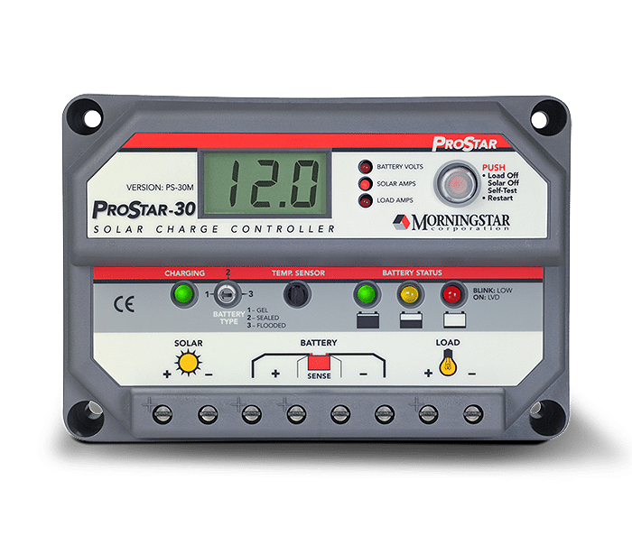
We added four 90W panels to the top of our bimini (and a Morningstar Pro-Star 30-amp PWN solar charge controller [1] installed in a cockpit locker) only a week or so before leaving. This addition changed our cruising life (while at anchor or sailing) -- effectively removing all worries about our battery charging while in Mexico [2].  With so much sun in Mexico, it was common for this system to provide 13-16 amps/hr charging in the midday, and 5-6 amps/hr on cloudier days [3]. We had little worry even with our air-cooled Nova-Kool refrigerator running 24 hrs/day.


Marine SSB/HAM radio with Pactor 4 modem, airmail software, and Sailmail membership:  


This system [4] was critical to us for obtaining marine weather information in Mexico, as well as the Neah Bay-to-San Francisco offshore section [5].  

We wrote about weather forecasting in a previous post. There is no official marine weather forecasting (that we could find) in Pacific Mexico; no forecasts are available the VHF radio [6].  The only forecasts available, all unofficial or experimental, must be obtained in one or more of the following ways: (i) downloaded from the internet, or (ii) audio (i.e., listened to) on Marine SSB/HAM radio [7].  


Audio forecasts are primarily: (i) Geary's excellent (but, nevertheless, amateur) daily forecast delivered on the SONRISA HAM SSB Net each morning, and (ii) Stan's computer-generated (no human input) forecasts read out on the AMIGO Marine SSB net each morning. (These forecasts, plus extra information, are easily downloaded from the internet or by using low-bandwidth email such as SSB/HAM-based or Satellite Phone-based airmail/sailmail and SailDocs.)  


Not to be underestimated, additional real-time on-the-spot weather information is obtained by listening to boaters when they check-in on the SONRISA and AMIGO nets; moreover, individuals may, and often do, request "weather fills" (additional details for specific areas) from Geary; this audio information is not available on the internet or by using a satellite phone.  

Forecasts on the Internet: in addition to Geary's and Stan's forecasts, experimental NOAA forecasts, and other forecasts are available as text files (most easily using Saildocs). GRIB files are also easily available to download (these files are computer-generated "forecasts" in graphic form which have no human input and thus do not take multiple factors into account such as local conditions, topography etc). While at sea or at anchor (and away from broadband or cell-phone based internet), these files can be downloaded using a satellite phone with a data plan or, as we did, using our Marine SSB, Pactor modem, and Airmail software (and Sailmail membership)[8].  Another great feature of  Marine and HAM SSB radios is the ability to talk to other boaters located up-and-down the coast (or on a passage), and to learn the locations of others, often friends, by listening to the SONRISA and AMIGO nets, or other nets such as the Pacific Seafarer's Net (difficult or not possible using a satellite phone).[9]


Shawn & Heather's (Blue Latitude Press) Guidebooks and Waypoints:  

As we noted in our earlier post, the Blue Latitude Press guidebooks are excellent and essential [Sea of Cortez: A Cruiser's Guidebook. 3rd Ed.; Pacific Mexico: A Cruiser's Guidebook]. 

Additionally, we downloaded digital/electronic versions of all their waypoints [10] so that they could be easily transferred to our Furuno chartplotter as well as to a computer-based charting program (OpenCPN) [11]. The guidebooks provide large-scale detailed chartlets [12], with the locations of these waypoints accurately indicated. (These chartlets are also available as electronic charts -- see Note #12.) Given the lack of  accurate and detailed marine charts for most areas of the Mexican coast, Shawn and Heather's accurate waypoints gave us confidence in navigating closer to shore and when anchoring. Download the waypoints, and don't leave San Diego without purchasing these excellent guidebooks [13].


(Bulk) Water Treatment System:  

Before coming to Mexico, have a method to treat water obtained from marina and fuel dock taps. We recommend obtaining a Filter/UV Sterilization system.

Most cruisers reading this heading will immediately think "watermaker", but this is not what we are referring
to. Due to pollution (especially the slightest bit of gas, diesel, or oil), watermakers are rarely useful in marinas, as well as in some crowded anchorages where there may be poor water circulation and/or pollution (e.g., Barra de Navidad lagoon).

We stayed in marinas a lot (especially Marina Palmira, La Paz). A watermaker, if we had one (we don't), would be useless here [14]. Many cruisers purchase water for their tanks; at about C$2.50-$3.00 per 19-litre garrafone arranged through a marina (a little less if you do not need to tip staff from the water company, or deal directly with agua purificada store), filling our tanks (~460 litres or 24 bottles) can really add up (C$60/fill!). Additionally, lugging these large heavy bottles to the boat and the subsequent pouring into the tank fills are a pain. Finally, in many places it can be difficult to find more than a few bottles at a time. We usually used dock water, filtering and chemically treating the water.

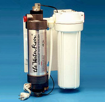
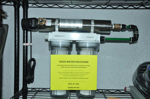
Rather than purchasing water in bottles, some cruisers treat the water at their dock taps using combinations of filters, UV sterilization, and/or chemical treatment.  Waterfixer makes Filter/UV sterilization systems (available directly from manufacturer, or through Downwind Marine in San Diego). Tom at La Paz Cruiser's Supply also sells a filter/UV Sterilization system. One hooks the water hose up to the filter/UV system, applies power (12v or 110v, depending on version purchased), run it a bit to clear filters, then take its output to the boat's water tank(s). The system is portable and can be temporarily hung on the lifelines while filling.

In our case, we first filtered the dock water as we put it into our tanks, then chemically treated each tank (using a solution similar to Microdyn, but a much less expensive Soriana/City club store brand). This system worked well for us [15]. A better system, however, is a combination filter/UV sterilization system, such as noted above.


Fans to cool you off in hot weather:

It gets really hot on the boat in Mexico!  Short of an air conditioner (which we certainly did not have), the primary way of cooling off inside was by using fans (in addition to open hatches and windscoops). Before leaving Vancouver, we installed two fans in the V-berth, two fans in the main salon, and one fan in the galley. All of these fans were Caframo "Bora" 3-speed fans, which were fairly powerful (for their size), (relatively) quiet, and very easy on the batteries.

Be sure to bring multiple spares of your fans: when we returned to Mexico after leaving Pelagia in Mazatlan for the Summer, we found the 3-speed switches on two fans were stuck in one position (rather suspiciously, the two broken fans were next to windows that had been replaced over the Summer -- we believe their problems stemmed from damage occurring when the windows were removed and/or replaced). Fortunately, we had one spare Bora, plus a used spare Hella 2-speed "Turbo" fan to replace the damaged Boras. The Hella Turbo is noisier than the Caframo Bora, and has no protective grid at its back, making it awkward to adjust the fan when it is running. We prefer the Boras.


Bug screens for windows/hatches and companionway:

Whether it is the pesky little mosquitoes whose "bite" carries a real itchy punch (and, possibly, Dengue fever), nasty "jejenes" ("hey-hey-nes", no-seeums) which are tiny and give a rash of itchy sores, or bees searching for fresh water, you need a good bug screen setup for your boat.

Our new Lewmar portlights came with somewhat flimsy but effective bug screens; for the hatches and the companionway, we purchased "Sogeman Bugbuster" screens, which worked very well. These are available direct from Sogeman, as well from many online marine businesses in Canada and the USA.

A real downside to bug screens is that they really cut down on air flow -- a real problem when the temperatures heat up!


Other essential items (we already had on Pelagia)
(i.e, not installed specifically for Mexico)
  • 25-kg ROCNA anchor and 300' all-chain rode, with Lewmar V2 windlass [16]
  • Furuno 1724C Radar/Chartplotter (with annually-updated C-Map card)
  • Wagner S50 Autopilot. Old technology (not computer compatible...), but a workhorse that always kept true 
  • OpenCPN PC-based charting system with official USA and Canada RASTER charts, CM93 worldwide VECTOR charts, and GE2KAP/Google Earth software (for preparing GPS-accurate Google Earth "charts")
  • Nova Kool LT201-RT6 air-cooled refrigerator in ice box with 3-inch insulation [17] Kept items cold; froze meats and kept them frozen; and made ice (using only the RT6 ice box as a freezer). As noted above, our solar charging system had no problem keeping up (and surpassing) the energy demands of this 2.2 amp/hr Nova Kool system.


Detailed notes:

Solar panels/charge controller:
[1] We had planned to obtain a MPPT controller. However, the solar power specialist from whom we purchased the panels and controller strongly recommended a PWN over the MPPT controllers. When we objected ("but online blogs and 'experts' say we must get a MPPT controller...!"), he went so far as to telephone a Morningstar representative, who also agreed with his advice: we would be paying extra money for a MPPT controller but receive no benefit due to the small size of our solar array. For those concerned with electrical noise from the PWN controller during SSB/HAM radio use, we found such noise was only an issue when the PWN controller went into Stage 3 charging; it was simple to turn off the controller when required.
[2] The only time we had concerns with charging and battery levels was on the 3rd day of our Ensenada-to-Turtle Bay passage; all three days (and 2 nights) were cloudy and the combination of sailing, lower panel output, and (too much) use of the autopilot resulted in lower battery levels. Our first day in Turtle Bay, it rained solid for most of the day. This was the one and only time we felt we needed to use our Honda generator.  
[3] Back home in British Columbia, we still seem to be getting 12-15 amps/hr charging late morning until early afternoon on sunny days, and 4-8 amps/hr at other times (and 4-8 amps/hr on days with high clouds).

Marine SSB/HAM radio with Pactor 4 modem, airmail software, and Sailmail membership:
[4] Our Marine/Ham SSB radio is the ICOM M802. This radio can be set to receive/transmit on all Marine and Amateur Radio (HAM) frequencies in the "high frequency" range (i.e., up to 30 MHz), and works very well for us. (However, there are other HAM radios with fewer "bells and whistles" (which we also did not use) available at a lower price.) Rather than the more-complicated ground-plane installation, we used the "KISS Ground Plane" (actually, a counterpoise) -- a very easy installation that worked very well for us (as well as friends on other boats), despite the "kerfuffle" sometimes associated with it.
[5] At times we were over 100 nm off the coast of Washington/Oregon/California, making reception of NOAA weather forecasts on VHF radio sometimes difficult (though, surprisingly, we were often able to receive VHF forecasts this far off the coast). However, even when we could hear forecasts on VHF, we still relied on the text forecasts downloaded using our SSB radio/Pactor modem. NOAA VHF forecasts would usually cover a small area, so it was hard to "look ahead", and equally important, the huge number of forecast regions off the West coast was very confusing, and having these forecasts downloaded and saved in text format made it easier to interpret. (We had very "difficult" weather -- gales and "hazardous seas" -- off of the Oregon/Northern California and we should have been better at evaluating the many NOAA forecasts....) 
[6] In several locations popular with cruisers (La Paz, Puerto Escondido, Mazatlan, Banderas Bay, etc), there are "cruisers' nets most mornings on VHF radio, when weather forecasts are read aloud (usually either Geary's or Stan's). These forecasts on VHF nets are not obtainable when one is farther away or when land mass intervenes. Also, in some harbours (e.g., Puerto San Carlos in Bahia Magdalena), the Port Captain reads aloud (in Spanish) a daily weather forecast on VHF radio. 
[7] Weather forecasts on Marine SSB and HAM SSB may be listened to by anyone, even those without a Marine ROC or an Amateur Radio (HAM) certificate (provided their radio can tune to these frequencies). Technically, a marine ROC ("restricted operators certificate") and station license (outside of USA/Canada) are required to transmit on marine frequencies (VHF and high-frequency marine SSB). A HAM certificate is required to transmit on HAM frequencies. However, in the case of a true emergency, HAM and Marine NETS will take calls from anyone.   
[8] Email access to HAM stations is free to HAMs using Winlink2000. Access to Marine SSB Sailmail requires a US$250/yr membership (and a marine "station license"). In Mexico, we found connections to HAM stations to be difficult, slow and often unobtainable. Sailmail stations, on the other hand, were easy to connect to and much faster than the HAM stations. (This situation continues for us in British Columbia.) 
[9] In the case of an emergency, a broadcast on marine and HAM SSB frequencies and associated NETS will be heard by boats nearby and far -- as well as by land stations --  possibly enabling faster assistance. A satellite phone cannot do this.

Shawn & Heather's (Blue Latitude Press) Guidebooks and Waypoints:
[10] One could, as many do, enter each waypoint manually. However, errors can occur doing it this way, and it is a lot work. The ease of downloading and transferring waypoints accurately makes the low cost of downloading these waypoints (US$4.95 per guidebook) an excellent investment. 
[11] We use GPSUtility to modify and transfer waypoints to our chartplotter (and other GPS systems).
[12] The detailed chartlets in the Blue Latitude Press guides are now available as GPS-accurate electronic charts for PC, Android, IPad and Mac. The charts are the same price for all platforms; however, software required to view these charts is expensive for PC and Mac, but quite reasonably priced for Android ("PathAway" charting software) and IPad ("INavX" charting software) tablets. See Blue Latitude Press and Fugawi X-Traverse websites. We only recently learned about these electronic charts, thus we did not have this while in Mexico. If we were returning to Mexico, we would definitely have these on our Android.
[13] Unfortunately, Blue Latitude Press guides do not cover the Pacific Coast of the Baja peninsula. Most of these areas do not have official large-scale detailed charts (electronic charts such as C-Map and Navionics reflect this lack of detailed charting), and the existing cruising guides, in our mind, are lacking in accurate details (especially, no GPS-accurate chartlets). In a subsequent post, we will suggest using OpenCPN charting software and GPS-accurate "charts" (Google Earth photos) produced using GE2KAP software to provide additional information for sailing down the outside of Baja (and, indeed, for anchorages elsewhere in Mexico).

(Bulk) Water Treatment System: 
[14] We do not have a watermaker. Given Pelagia's large water tanks -- and we plan to install a third water tank, replacing a 30-gallon diesel tank we removed two years ago --  and how much we stayed in marinas, we did not need one while in Mexico. Decent watermakers (e.g., Spectra) are very expensive, both in initial purchase (US$5000-$15,000), installation, and in ongoing maintenance. They require substantial energy to produce water, and usually take up a lot of space. Moreover, watermakers are easily among the most common items to fail during cruising (along with autopilots and refrigerators). So, a watermaker is still not on our "wish" list for Pelagia (although, given current drought conditions in southern BC, especially on the islands, one has to wonder...).
[15] In two seasons of cruising in Mexico, we had food/water-borne sickness only once: Giardia. We have no way of knowing where we picked this up (it takes 8-10 days for symptoms to show up, and they are not that obvious); likely it was from eating out (cruiser friends in La Paz were also hit by Giardia, at a different time, even though they only used bottled water in their tanks). Happily, Giardia is pretty easy to treat using Tinidazole (Fasigyn in Mexico) -- and we are pretty familiar with it from our many trips to Nepal. As for tank treatment: one could use chlorine (i.e., bleach) to disinfect water after filtering (the filtering is required to remove sediments and cysts/parasites such as Giardia and Cryptosporidium).  However, using chlorine to disinfect is not recommended for our aluminum water tanks.


Other items:
 [16] We never used more than 200' while in the Sea of Cortez (the remaining 100' is lower down in a 2nd chain locker below the V-berth. One never knows when one needs the extra chain (think Hurricanes...).  

[17] We purchased a new Nova Kool conversion system in 2013 -- similar to our existing and functioning  10-15-year-old Nova Kool system (that we had been told, in 2010, was on its last legs) -- stored it on Pelagia and carried it all the way to La Paz. This new system was supposed to be more efficient -- using only 2.2 amps/hour. We had Will at Techs Mex in La Paz install the new Nova Kool (the old Nova Kool was donated to a family in San Evaristo, where it was installed in conjunction with a large ice chest; with a charge of refrigerant, we are told it works great. So much for being on its "last legs".)   Other cruisers had more-expensive "fancier" systems. We were worried our comparatively simple (and less-expensive) air-cooled Nova Kool couldn't compete.  To the contrary, it worked great and gave us no problems.