 |
| Zihuatanejo harbour (O-Charts & OpenCPN) |
Best charting package: OpenCPN
(when combined with charts available for OpenCPN)
I have long touted OpenCPN. It is the most (or among the most) full-featured charting packages. It is continuously being updated/upgraded with new features, and support easily obtained.
My favourite OpenCPN features:
- Accepts most chart types: Raster [BSB/KAP (such as CHS and NOAA raster files), mbtiles; Vector (S57 ENC (such as free NOAA files), some S63, CM93v2, and O-SENC]
- Excellent waypoint creation and management
- Excellent route creation and management
- Presentation of AIS target information
- VDR (Voyage Data recorder): Save depth, AIS, etc data for later re-playing (and creation of depth surveys)
- and much more!
This open-source charting package is available free for PC, MAC and Linux, and for a very small one-time fee for Android. (Due to Apple's iOS licensing issues, OpenCPN is not available for iPhone or iPad.)
Best source of charts for Mexico's Pacific Coast: O-Charts
I've recently had the opportunity to review the O-Charts (Open Charts) Mexico charts. I've focused on the Pacific coast.
(1) O-Charts' SEMAR charts:
A new addition, O-Charts now offers official Mexico charts from Mexico's SEMAR. Charts are in two sets, one for Mexico's Pacific coast and the other for Mexico's Gulf of Mexico coast. Each chart set is offered for a very reasonable price (26 to 30 euros/set), which includes free updates for 1 year (update frequency is reported to be weekly). Most of these charts are fairly recently issued and/or have received recent updates. They are not old charts "from the 1800s" so often alluded to by misinformed cruisers.
-OCHARTS.jpg) |
| SEMAR (O-Charts): Entrance to Sabalo (Mazatlan) |
 |
| SEMAR (O-Charts): Sabalo (Marina Mazatlan) |
Pacific Mexico: The O-Charts' SEMAR packages are from SEMAR's ENC (vector) charts. NOTE: Although extensive, the SEMAR ENC collection is missing several charts from their RASTER collection. This means a few key locations for cruisers are missing from O-Charts' SEMAR package. With two exceptions (see below), these few locations on raster charts missing from SEMAR ENC are all easily replaced by also purchasing Blue Latitude raster charts from O-Charts.
Commercial chart sources, such as Navionics and C-MAP, all obtain their Mexico chart information from SEMAR. Sometimes these commercial charts include data from both vector and raster from SEMAR are included, other times only vector.
However, it is important to note that SEMAR data (and thus Navionics/C-MAP) usually does not cover popular small-boat anchorages.
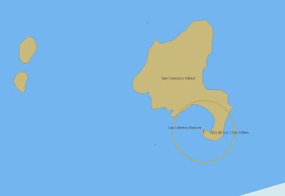
The solution is to add Blue Latitude charts, as shown in the following example for Isla San Francisco, below:
 |
| Navionics: no data for Isla San Francisco |
 |
| SEMAR (O-Charts): no data for Isla San Francisco |
 |
| Blue Latitude (O-Charts): Detailed chart for Isla San Francisco (from guidebook) |
(2) O-Charts' Blue Latitude charts:
O-Charts has for some time offered the two Blue Latitude chart sets for the Sea of Cortez and Pacific Mexico (36 euros per set). These chartlets, found also in the excellent Blue Latitude guidebooks, provide GPS-accurate charts for all the main harbours and hundreds of small-boat anchorages on Mexico's Pacific coast (excluding the west coast of the Baja peninsula). NO other charts provide such detail.
These charts are essential for west coast cruisers.
For cruisers, the combination of SEMAR and Blue Latitude charts, both available from O-Charts, provide excellent coverage of Mexico's Pacific coast.
The two important exceptions:
O-Charts SEMAR Pacific chart set is missing detailed charts for two key locations for cruisers on the west coast of Baja: Turtle Bay and Bahia Santa Maria/Bahia Magdalena. Unfortunately, these locations are not part of the Blue Latitude chart sets, as they do not cover Baja's west coast.
There are easy solutions for charts for these two Baja locations:
- LINK to download these missing charts for use in OpenCPN (6 MB). A great option of OpenCPN is that it allows one to use mbtiles charts of Navionics (or C-MAP) made using SASPLANET and SAT2CHART software.* I have made up these charts for Turtle Bay and Bahia Santa Maria/Bahia Magdalena. (Another key feature of OpenCPN is that one can use detailed satellite-image "charts" for the many poorly-charted anchorages along Baja's west coast, made using SASPLANET and SAT2CHART.)
- Most up-to-date chart cards for chartplotters (Navionics, C-MAP) will have detailed charts for these two Baja locations (derived from SEMAR's detailed raster charts)*
- Navionics and C-MAP iOS/Android apps also contain detailed charts*
* Note: Navionics/C-MAP do not provide more detailed charts (compared to O-Charts' SEMAR) for other areas of the west coast of Baja. For the many poorly charted locations on Baja's west coast, I recommend making detailed satellite images (mbtiles are best) using SASPLANET/SAT2CHART and OpenCPN.