Saturday 24 December 2016

Season's Greetings!


Warm weather and beaches are so over-rated...!


Best wishes for the Holidays.
Merry Christmas and Happy Hanukkah.

Happy New Year 2017.

Monday 19 December 2016

Back skiing!


3.5 weeks after tearing his right calf muscle, David is finally back on the mountain. Just in time as we received 31 cm of powder in the past 24 hours (not that he went near the pow... calf is not ready for that yet).

A little less of an "old man" today.

Friday 2 December 2016

Instant old man...

 
Tons of snow for opening days at Whistler (November 23rd) and Blackcomb (November 24th) -- over 200 cm new snow in a week.

Unfortunately, a gentle forward tumble in the powder on Day 2 has put David out of action for at least 3-4 weeks: a Grade 2 right calf pull (or strain, tear, etc.). This injury feels very similar (and not worse) to his left-leg injury back in 2012 (running to catch the bus here in Whistler) -- it required 3.5 weeks to get  back on the mountain. This time, though, help from a physiotherapist has been sought (who informs him that it gets worse with age...).


So much for being in such great shape after our 12+ day trekking in Nepal!  🙁


Meanwhile, Michelle is skiing up a storm in all the new snow.


Friday 18 November 2016

Back home in Whistler, BC: Snow on the mountains!

We are now back home in Whistler.

While away in Nepal, a warming trend melted much of the snow on the mountains. However, it has been (and is currently) snowing, and we fully expect to be skiing next week!

We have updated our preceding blog post (with photos) concerning our Poon Hill/Annapurna Base Camp treks, and have posted all our Poon Hill/ABR trek photos on an album on our FLICKR account:
https://www.flickr.com/photos/sv-pelagia/albums/72157675133841272 

Tuesday 8 November 2016

Ghorepani-Poon Hill and Annapurna Base Camp treks finished


Annapurna Basecamp panorama (Annapurna far left; Macchupucare far right)

Poon Hill panorama (Mt. Dhaulagiri far left)

We are now relaxing in Pokhara after completing our 13-day/12-night trek to Poon Hill,  followed by the trek up to Annapurna Base Camp ("ABC").


We have published our photos on an album on our FLICKR page: https://www.flickr.com/photos/sv-pelagia/albums/72157675133841272


It is high season for trekking in Nepal (October &  November) and the trails are very busy.  We had no issues with finding space in lodges on the Poon Hill portion of the trek,  but the ABC portion above Chomrong posed problems for us (due to ACAP restrictions on the number and size of lodges).  We expected this; still,  it added tension to the trip.

Michelle with backpack:at the start at Nayapul
David with backpack: Up the stairs to Ulleri


We carried our own packs and needed no guide -- the trails are very clear and we've done much of this trek previously 1-3 times.  Our trek went well and we are pleased that, at over 60 years of age, we can still trek carrying our own packs.  Nevertheless, we found this trek to be a lot of work:  thousands of stairs up and down,  and on the ABC portion,  the trails were often very rough and rocky.

View from Chomrong: trail goes down to river then up to Sinuwa (far right)

Looking back to Chomrong from lower Sinuwa (so many stairs...)

The views at ABC,  especially of Annapurna (which is very difficult to see on other treks),  were stunning (see photos).  Views of the whole Annapurna Himal from view points near Ghorepani (Poon Hill, and especially "Gurung Hill" on trail between Ghorepani and Deuralii/Tadapani) were also beautiful.

At the memorials to climbers' killed on Mt. Annapurna (Annapurna in the background)

ABC panorama; Mt Annapurna centre-left

View from ABC down towards MBC (Mt. Macchupucare far right)
However,  compared to our many other treks,  the ABC trek just doesn't match up.  A ton of work for,  essentially,  a couple hours of a stunning view. Above Chomrong (i. e.,  the whole ABC portion),  there are no villages and no culture.  (In contrast,  the Annapurna Circuit has days and days of remarkable views, villages with diverse cultures and great trails - - with comparatively few stairs.)

We've now done the ABC.  Once is enough.

And we're now in great shape for skiing!


Some trek details (for those interested):

Trek route (with stops at night indicated)
Duration of trek: 12 nights/12.25 days

Start: Nayapul
Night 1: Tirkedunga (Chandra Lodge)
Night 2: Banthanti (Four Seasons Hotel; best lodge on trek)
Night 3: Ghorepani (Snow View Lodge; good lodge; all rooms with toilet/shower cost only 400 NR)
Night 4: Tadapani (Tadapani Guest House; good rooms but smoky dining room)
Night 5: Chomrong (International Guest House; not the best food)
Night 6: Bamboo (Buddha Guest House; good room; nice folks)
Night 7: Deurali (Shangrila Guest House; so-so rooms and very crowded; good food; helpful)
Nights 8 &9: Machapuchare Base Camp (Gurung Cooperative Guest house; reservation at first not honoured)
Night 10: Bamboo (Buddha Guest House; good room; nice folks)
Night 11: Chomrong (Chomrong Cottage; excellent food and nice folks)
Night 12: Beehive (Beehive View Lodge; good room; quiet and quaint)
End: Siwai

Trekking costs (for 2):
Total cost for 2 (excluding transport, ACAP & TIMS) in Nepal rupees: 35,805
(Note: We did not have drinks such as Coke/Sprite or beers on trek; these would add significantly to costs)
Daily cost average (12.25 days) for the 2 of us: 2923 N rupees/day or C$37.47/day or US$28.38/day

Transport costs:
Pokhara to Nayapul: 2000 rupees (private car)
Siwai to Pokhara: 4000 rupees (taxi)

Saturday 22 October 2016

Off for a trek in Nepal

Annapurna South (from Tadapani, November, 2002)


During the interregnum (the time between our king/queen sports of hiking/sailing and skiing), we have decided to head back to Nepal for a "short" trek (15-day trek).

Current plan is to head to Pokhara and then hike the Poon Hill-Annapurna Sanctuary (also known as "Annapurna Base Camp") trek. We are going "independently" (without guide or porter) as we know it well (we''ve done 80% of this several times before), there are frequent and excellent lodges, and we are in no hurry with no great goals (unlike in 2014, we have no 5400 m passes to cross). But of course, plans can (and do) often change.

Back home in Whistler in time for skiing to start early!

Wednesday 19 October 2016

Changing seasons...

Brandywine Meadows (looking across to Black Tusk), August 30th, 2016

After returning from our Vancouver Island circumnavigation, our plan was to return to Whistler to get some "mountain" time. During August-September, we did numerous dayhikes, as well as one 2-night/3-day backpack. We soon found  out that our 2+months on Pelagia this Summer didn't help to keep us in hiking shape.

Black Tusk (from trail to Mt. Price), September 13, 2016


Looking south towards Whistler (from trail to Cougar Mt.), October 2, 2016

Ancient Cedars trail (October 2, 2016)

Enjoying our time in the mountains, we only managed one 3-night trip out on Pelagia, with one very wild sail (average 7+ knots) for 5 hours. During that short trip, we reconnected with David and Gillian on SV Carousel (our "buddy boat" for a few weeks this past Summer. Pelagia is now "bundled up" for the Winter.

As October came along, the season did a fast shift from Summer to Fall to perhaps "early" Winter. The aspens and other trees have turned golden and other colours. Bears (and other animals) are frantically filling-up with food for their Winter hibernation.

Bear in our parking lot (filling up on berries from tree), October 8, 2016

And to everyone's great excitement -- well, perhaps not the bears' -- snow has now blanketed the upper half of the mountains. Lots of snow (over 76 cm fallen as of Oct 18th)!


Snow on Blackcomb Mt., October 9, 2016
Whistler Peak, October 9, 2016
Looking down 7th Heaven, October 9, 2016
Emerald  chair on Whistler Mt, October 19, 2016

Skiing officially starts November 24th -- we're hoping for an earlier start!

Wednesday 31 August 2016

Vancouver Island circumnavigation UPDATE: Posts updated with photos

Just a quick note...

We have now added photos to our posts for our Summer 2016 circumnavigation of Vancouver Island.

Sunday 28 August 2016

Vancouver Island circumnavigation: the numbers


[Under construction...]

Total distance: 976 nautical miles
Total number of days: 79
Number of nights at anchor:   55      At a dock: 20         On a mooring: 3
Number of new (to us) anchorages/docks/moorings: 18


Engine hours: 178.6 hours
Number of days with (some) sailing:  13
Longest sail: 26.2 nm (Scotch Fir Point to Copeland Islands)
Number of days travelling in thick fog (visibility <1 nm): <1 day total ( an hour here and there)


Favourite anchorages (tied): Battle Bay/Nuchatlitz/Lucky Creek
Most stunning anchorage views (tied): Princess Louisa Inlet/Nuchatlitz
Favourite towns/villages (tied): Sointula/Port Alice/Ucluelet
Favourite docks: Sointula public docks (Malcolm Island Lions Harbour Authority)


Worst experience: Tofino waterfront and "anchorage"


Wednesday 17 August 2016

Back to the mountains...

Wildflowers on Whistler Mt
Our circumnavigation of Vancouver Island is now complete, and we are back home in Whistler, enjoying the mountains. It's hot up here!

We ended our circumnavigation with a few nights on Pelagia in the Gulf Islands. Beautiful as ever, but oh so crowded. We really were spoiled on the west coast of the island as well as in the Broughtons. Prior to the Gulf Islands, the most boats we had in an anchorage was 14 (the one night in Joe's Bay in the Broken Group), and that was an aberration (other places in Barkley Sound had only  1-4 other boats anchored).

So, we were happy to get Pelagia back to her home berth at the Vancouver Rowing Club.

Black Tusk from Whistler "High Note" trail

Overlord Glacier and Mt. Fissile from Decker Loop trail (Blackcomb Mt)

Friday 5 August 2016

Back down south...

South entrance to Dodger Channel from inside (shallow at zero tide) -- Cape Beale behind
We spent two nights at Dodger Channel*, trying to judge weather, allowing us some kayak time. Dodger is a great location: a wild, west coast anchorage (you can hear the swells breaking outside, yet it is calm inside), close to Cape Beale and hence a great jumping off spot to head south/east to Sooke and beyond.

* Note: the South entrance to Dodger Channel is only about 3 feet at zero tide, contrary to the 9+ feet indicated by at least one popular guidebook, as well as the 2.8 metres (>9')  suggested by the CHS chart (however, the CHS chart does not indicate this is the minimum depth).
 
After a couple days in the anchorage in Dodger Channel, we headed East/South towards Port Renfrew.  We elected (slept in)  to leave Dodger Channel later (10 am)  in order to miss the fog and hopefully to get some afternoon wind..  We were successful with the fog (none all the way past Victoria),  but the wind didn't come up until Port Renfrew.  We were going to anchor at Thrasher Cove,  but it was blowing 15-20 knots with wind waves in this small anchorage.  Fortunately,  the new "Pacific Gateway"  marina in Port Renfrew had space.  (This brand new in 2016 marina has great docks and,  importantly,  an excellent high rock breakwater.  Space for larger boats is limited so making an advance reservation is recommended.)

Next day,  we waited again for fog to clear, and (hopefully) for winds to pick up.  This time we were lucky,  with a wonderful sail from San Simeon all the way to Becher Bay,  with Fin our Hydrovane steering us (and no fog!).

It was blustery in Murder Bay (Becher Bay)  but it was nearly empty, no seas and an excellent anchorage.

Next morning,  we waited for slack current at Race Passage, then motored the 35 nm all the way to Sidney in the sun, helped by a flood current in many places.

Our trip down the west coast of Vancouver Island completed.

Friday 29 July 2016

Lazy days in Barkley Sound

After a couple days provisioning (and going out for dinner!) in Ucluelet -- again, a great place to visit and great public docks -- we headed out to the Broken Group (Pacific Rim National Park), aiming for the anchorage between Dodd and Turtle Islands (sometimes referred to as "Joe's Bay"). When we arrived, we were only the third boat, so we were a little surprised later to have 14 boats (10 from the USA, most from the Portland Yacht Club) around us (including a very large 60+' motor-sailor that wanted to anchor only some 60 metres from us and another boat -- even though at the time the bay was 2/3 empty... ARRRRGH!).* It was still a quiet night.

[* Turned out, the 14 boats was an exception -- the rest of our time in Barkley Sound would only see 1-3 other boats anchored with us.]

Next day we headed out of the Park over to the Pinkertons. We found solitude, and stayed put for three nights (only one other boat came in). We got in a couple of good kayak trips, and even spent a few hours losing lures and flashers (as opposed to catching any fish -- well, we caught a couple too small ones we returned to the sea). Mornings were very foggy, but usually the sun burned off the fog and the afternoons were sunny.

Kayaking in the Broken Group

Pelagia, anchored in the Pinkertons

Next, we moved to Pipestem Inlet, to the anchorages near Lucky Creek, where we are currently. After trying a couple anchorages with only partial success (rocky bottom), we finally got a spot behind Refuge Island later when others left. Sea water temps are up to 23.5 degrees C -- great swimming temperatures; Sea of Cortez temperatures. So we have been in the water multiple times. Nights, so far, have been very calm. Last night, we scored a huge filet of fresh-caught salmon from folks on the Victoria-based sailboat "Saturnus" -- very very nice of them to come to the aid of this terrible fisherman (David). Today, we kayaked up Lucky Creek to its great fresh water swimming pools and falls.

Kayaking up Lucky Creek

Lucky Creek

Cool, clear water of Lucky Creek

After Lucky Creek, we picked up some fuel and water in Bamfield, then headed over to Dodger Channel.* Dodger is a great location: a wild, west coast anchorage (you can hear the swells breaking outside, yet it is calm inside), close to Cape Beale and hence a great jumping off spot to head south/east to Sooke.

* Note: the South entrance to Dodger Channel is only about 3 feet at zero tide, contrary to the 9+ feet indicated by at least one popular guidebook, as well as the 2.8 metres (>9')  suggested by the CHS chart (however, the CHS chart does not indicate this is the minimum depth).

We spent two nights at Dodger, trying to judge weather, allowing us some kayak time.

Kayaking in Dodger Channel area

Friday 22 July 2016

Tofino: Not a friendly place for cruising boats

UPDATE: There is a relatively new marina/resort in Tofino. Very little space (esp for boats >30') and pricey (2023: C$4/ft!). Reserve ahead! https://tofinoresortandmarina.com/the-marina-2/


Just a short note for cruisers considering a stop in Tofino: don't bother. Go to Ucluelet.


Moorage at Tofino's public dock is extremely limited for transient cruising boats -- during July/August cruisers will almost certainly have to "raft" if  they can find space. (Another cruiser suggested the problem is due to the high rents in Tofino, resulting in more liveaboards. However, this problem was also present 14 years ago in 2002.) We didn't see any space, so elected to anchor off the marina (as we did in 2002, when we also found the public docks to be a poor choice). Well, there was 3-5 knots of current roaring through the anchorage which was full of crab traps (thanks Tofino locals!). We managed to get anchored and ate lunch while we watched the "river" flow around us, and saw Pelagia getting too close to propeller-snagging crab-trap lines. (The night before, a friend had been anchored on the other side of this anchorage, and had been yelled at by a tug boat skipper for being "in the channel".) While anchored, we also watched (with anger) tour boats roar by (at 20-30 knots), with no regard to the effects of their wake on us. Meanwhile, float planes kept landing near us.

With all this cacophony and the dicey anchorage, we decided to get away from Tofino. We planned to head over to the anchorage at Windy Bay, ~7.5 nm away, which would add 1.5-2 hours to our trip to Ucluelet the next day, but would at least be safe and peaceful. As it turns out, as we went down Browning Passage, we felt it might be possible to anchor on the side of the wide portion of this passage a mile or so South of Tofino. The current was still swift, but there was tons of room and no boats passing close by. (And, to liven things up, just as we got our anchor down, a grey whale surfaced right beside Pelagia, giving the stink eye to Michelle -- and stink breath -- and really giving her a fright!) Not sure why guidebooks haven't suggested this as an anchorage option (which made us wonder if there was some problem, such as a fouled sea floor, which we would find out the hard way the next morning).

Our night was quite peaceful, and the next morning, we weighed anchor (thankfully with only seaweed to clean off), and, with a fast ebb flowing out to the ocean (including at our anchorage), we zipped past chaotic (and cruiser unfriendly) Tofino and headed to Ucluelet.

Arrival in Ucluelet presented such a positive contrast to Tofino: there is a speed limit in the harbour which seems to be observed, so no boats roaring by; Ucluelet public dock is so well organized, the harbourmaster Kevin (and staff) very responsive, even meeting your boat to help with docking. Provisioning in Ucluelet is excellent.  Ucluelet is a very nice town.

Note to Tofino Town Council: if you want cruisers to visit, make it more friendly to cruising boats. Learn from places who do it right like Ucluelet, Port McNeil, Sointula, etc. As it stands, Tofino seems only to care about tourists going out on whale-watching and hotsprings tour boats, as well as sportsfishers. Until this changes, we will avoid Tofino.

Sunday 17 July 2016

Checleset Bay, Kyuquot and Esperanza/Nootka

Motoring towards Brooks Peninsula

Solander Island (Brooks Peninsula behind)

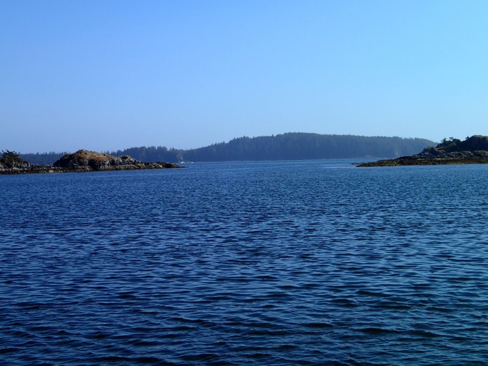
After rounding the Brooks Penninsula, we anchored with SV Carousel in the west side of Battle Bay. Dotted with rocks with beautiful beaches, this was a beautiful place. It felt like the wildest place we'd anchored in so far. The following day, we were joined by Rolly and Marian on MV Tropic Isle for a dinner with 8 of us on Pelagia. (This rendezvous had been arranged a couple days earlier via HAM radio on the Great Northern Boater's Net.) We first met Rolly in 2002 while on a mooring buoy at Columbia Cove (only a few miles away from Battle Bay; the mooring buoys have been removed), and have crossed paths a few times since then. Rolly is well-known up-and-down the B.C. coast (and even in Alaska): at 80 years young, he has circumnavigated Vancouver Island at least 25 times. Every Summer he does a long trip, with Marian joining him at different points. We had great fun at dinner on Pelagia, Michelle having cooked up at wonderful chicken curry in the pressure cooker.

Battle Bay anchorage

Bear on the beach (Battle Bay)
Battle Bay

Rolly & Marian (MV Tropic Isle) in Battle Bay

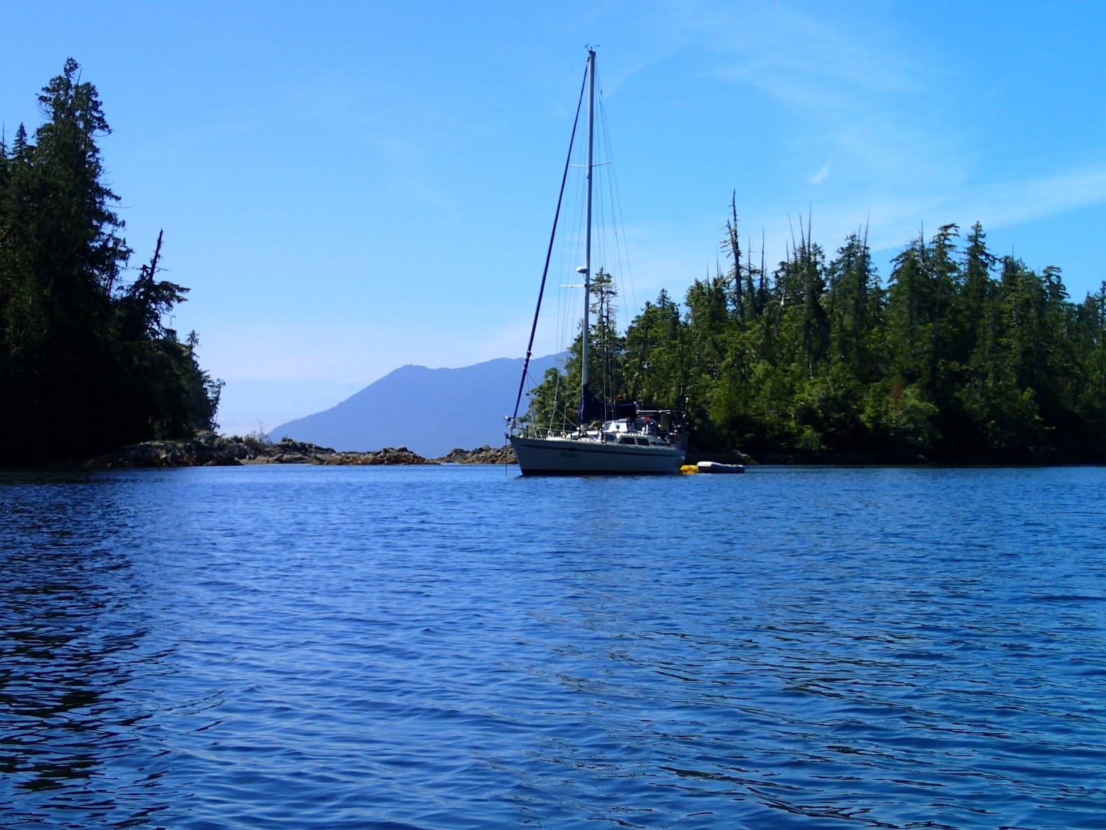
After Battle Bay, Rolly offered to "guide" us through rock-strewn "False Gay Passage" (not the official name, but a passage cruising guides warn "not to enter") and then to an unknown, uncharted special anchorage not in any cruising guide. The passage was a little nerve wracking but following both MV Tropic Isle and SV Carousel, it turned out OK. Passage into the secret anchorage was a little more eventful: the other two boats draw 4.5 feet, Pelagia draws 6 feet. Rolly indicated the narrow pass into the anchorage would have more than enough depth. After Carousel and Tropic Isle went in with no issue (and reporting 15 feet depth), we followed. We probably were 5-10 feet off-centre in entering, and "found bottom". That is, we skidded over the top of a rock: didn't stop moving and the touch was pretty "smooth". We anchored and then surveyed the entrance: turns out there was indeed a rock with about 5-6 feet over it when we entered (3-4 feet at zero tide).

[Update: weeks later, in Pipestem Inlet, with water temperatures as warm as 24 degrees C, David finally got to dive and check Pelagia's keel. As expected, there was only a small nick on the bottom. clearly, we had barely hit the top of a flat rock. No big deal.]

Following SV Carousel and MV Tropic Isle in the Bunsbys

Entrance to secret anchorage (from inside): a rock lies in the middle...

Anchored in the Bunsbys
The secret anchorage was a great anchorage. We kayaked nearby, guided by Rolly, to a 1st Nations burial cave, complete with coffin boards, bones and skull. (We viewed it from the outside and did not enter the cave nor took any photos, out of respect.) We then kayaked over to kayakers' campsites on another nearby island. It was a very interesting day (mostly good, with a little "bad"...). That night, weather was to turn rainy, and a Southeast wind was predicted. It poured hard all next day and the wind picked up. The anchorage was well protected: Tropic Isle had the best spot, with nary a breath of wind; Carousel had occasional gusts; Pelagia had constant wind. (but no waves, indeed barely a ripple.) Interesting differences over a couple hundred feet. During the rain, we still had a great dinner over on SV Carousel. That night, the winds picked up (apparently >25 knots out in Checleset Bay), causing David to keep an anchor watch (i.e., little sleep). True to Rolly's word, however, this secret anchorage was very secure in these Southeast winds.

Kayaking in the Bunsbys

1st Nation's Burial Cave

Battleship Island (Bunsbys)

Green Head (Bunsbys)

Next day, Rolly and Marian headed over to Columbia Cove, while Carousel and Pelagia headed to Kyuquot (sometimes referred as "Walter's Cove"). The winds were still blowing SE 20-25 knots, and we had to spend an hour or so beating through a narrow passage surrounded by waves crashing on nasty rocks in order to get to a more-protected route. An engine failure at any point could be very bad news, and David was always on the lookout for an escape route by sail. Happily, once through the rocks, the rest of the trip was fairly easy and comfortable. We arrived in Kyuquot in time to do a little grocery shopping (and water fill-up) at the Kyuquot store (currently only open MWF, 1-5 pm). We then went out for fish (halibut) and chips at "Java the Hut" (which also had free WiFi: trouble is, its WiFi "acts up" whenever it rains -- which it does routinely in Kyuquot -- so we had no WiFi).

Kyuquot public dock and store
Next day, we headed into Kyuquot Sound. Glassy calm, it was a relief from the winds outside. We anchored in a cove at the entrance to Amai Inlet referred to in the Douglass guide as "Petroglyph Cove" -- not that any petroglyphs can be seen -- and by the Dreamspeaker guide as "Blue Lips Cove" (supposedly named by locals due to the effects of a cold swim). Not sure what its real name is, but it was a nice anchorage.  The following day, SV Carousel left, heading southeast to Nuchatlitz, while we headed further into Kyuquot Sound to check out Dixie Cove. After over 3 weeks of travelling together, we found it sad to see Carousel leave. (We've kept in touch by HAM radio, but it looks like we will not be catching up with them.)

Goodbye to SV Carousel -- leaving Blue Lips Cove
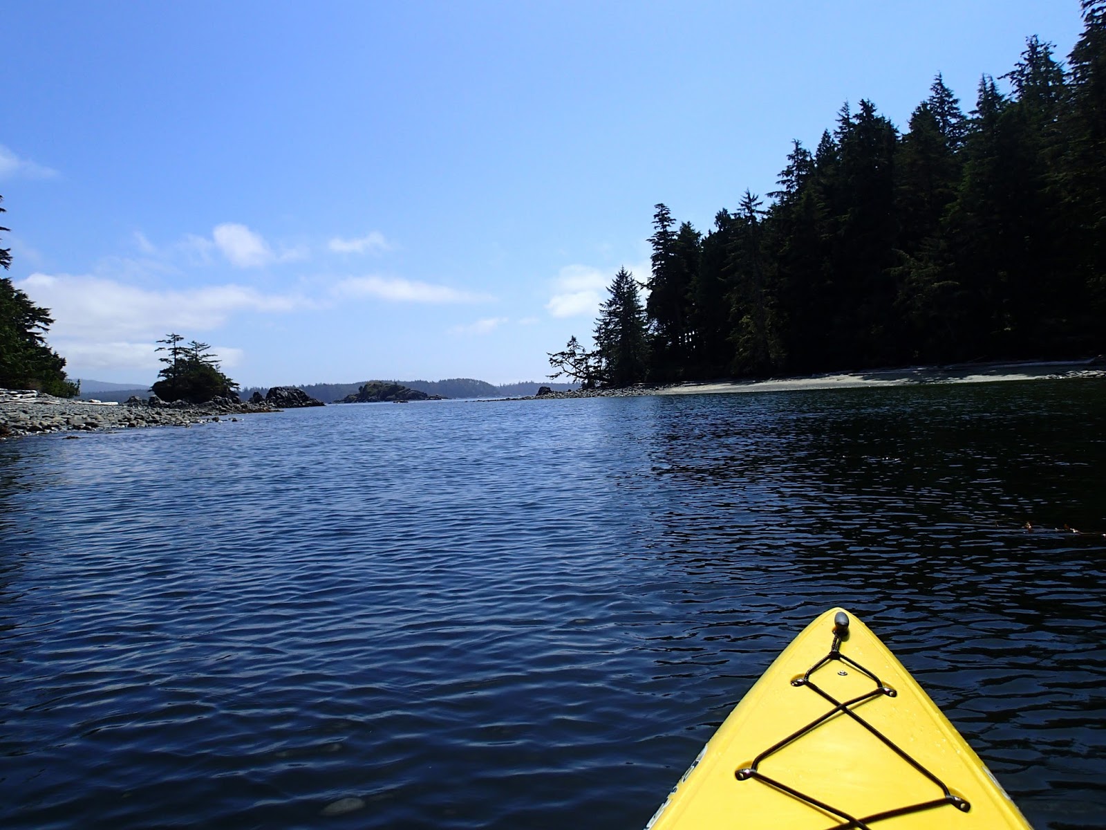
Dixie Cove was quite nice, and we had a day of sun, allowing us to go for a kayak. Rain arrived that night, and the next day was rainy (no wind) so we stayed inside the boat, our Dickinson furnace keeping us dry and warm. The next day we awoke to no rain but some fog. Another boat had headed out, and when we contacted them by VHF radio, they let us know that the fog had lifted. So we weighed anchor and headed out of the sound and motored through "Clear Passage", then to Nuchatlitz, at the entrance to Esperanza Inlet.  Nuchatlitz is a contender for the most beautiful anchorage of this trip. We stayed a second night, and enjoyed kayaking around the many islands. We even go to see a "raft" of over 30 sea otters. Damn cute!  Later that afternoon, we were invited for drinks and appies on SV Endless Summer IV. Turns out, this was the boat we had been told to look for (by another couple we met back in June in Von Donop Inlet), and they had also been told to look out for us. John and Pat (on Endless Summer IV) had helped us the day before by letting us know about the fog lifting; we helped them by using our HAM radio email to make a moorage reservation for them at the Westview Marina in Tahsis. Also joining us for happy hour were Gene and Carol from SV Pendragon. A nice time in sunny weather.  Next day, we motored up Esperanza and Tahsis Inlets and moored at the marina. We filled up with water and fuel and went out for an "OK" dinner at the marina; unfortunately, their WiFi system was hopeless and food shopping at the Tahsis store pretty sparse. The marina works hard, but caters primarily to sports fishers, and cruising boats are not a big priority. We were happy to move on to a quiet anchorage at the head of Kendrick Inlet at the top of Nootka Sound (where we were the only boat, and watched a bear roam the shore).

Kayaking at entrance to Dixie Cove (Kyuquot Sound)

Grogan Rock, Clear Passage
Nuchatlitz -- a favourite anchorage

Raft of sea otters (Nuchatlitz)


Nuchatlitz anchorage
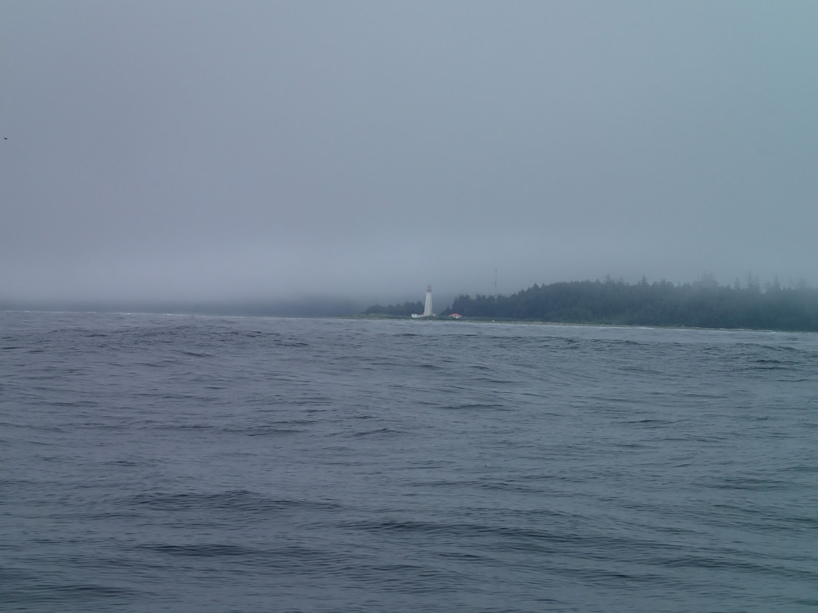
Next day, we motored down Nootka Sound to Friendly Cove (or "Yuquot" to the 1st Nations). We had a
sunny day to go ashore and visit this very historic (and scenic) place: visiting the small church, the former village site, graveyards, lake, and the Nootka Lighthouse. While we were anchored, the old MV Uchuck III arrived and docked, full of day-tripping (but respectful) tourists. Back in 2002, we anchored in Friendly Cove in thick fog, and didn't go ashore; we were glad to be able to have a better visit in 2016.

Entering Friendly Cove (Nootka lighthouse on left)

MV Uchuck III at Friendly Cove

Friendly Cove

Stained glass in Yuquot church
Yuquot church

Pelagia at anchor (photo from Nootka lighthouse)


Rounding Estevan Point of a calm, windless (and foggy) day
The following day, we went around Estevan Point. Although some wind was forecast, we never had enough wind to sail. But seas were comfortable. We arrived in Hotsprings Cove, at the North end of Clayquot Sound. We arrived to boatload after boatload of tourists doing quick "tours" from Tofino to the hotsprings. Meanwhile, on the permanently anchored "Innchanter" B&B nearby, there was a loud, obnoxious (and crude) party going on.

Clearly, we were no longer on the "wild west coast".